Mézel geodata
Mézel (Provence-Alpes-Côte d'Azur) is a populated place; located in France in Europe/Paris (GMT+2) time zone. With population of 576 people, there are 13727 cities with bigger population in this country. Compared to other cities in France, 87.1% of cities are located further ↑North; 89.3% of cities are located further ←West and 94.6% of cities have lower elevation than Mézel. Note1
Administrative division(s):
- Level 1: Provence-Alpes-Côte d'Azur
- Level 2: Alpes-de-Haute-Provence
- Level 3: Arrondissement de Digne-les-Bains
- Level 4: Mézel


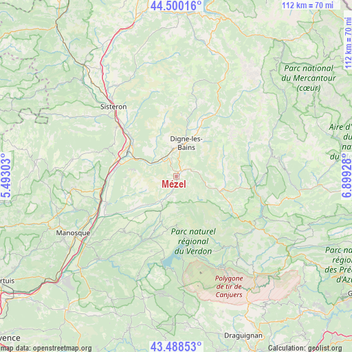
Mézel GPS coordinates[2]
43° 59' 47.4" North, 6° 11' 46.14" East
| Map corner | latitude | longitude |
|---|---|---|
| Upper-left | 44.50016°, | 5.49303° |
| Center: | 43.9965°, | 6.19615° |
| Lower-right: | 43.48853°, | 6.89928° |
| Map W x H: | 112.5×112.5 km | = 69.9×69.9mi |
| max Lat: | 51.07786° ⇑87.1% North |
| Mézel: | 43.9965° |
| min Lat: | ⇓12.9% South 41.3874° |
| min Long | Mézel | max Long |
| -5.08615° | 6.19615° | 9.52242° |
| W 89.3%⇐ | ⇒10.7% E |
Elevation
Elevation of Mézel is 564 m = 1850 ft, and this is 370.3 m = 1215 ft above average elevation for this country.
| Max E: |
2333 m = 7654 ft | 5.4% |
| Mézel | 564 m 1850 ft | |
| Avg. | 193.7 m = 635 ft | |
Min E: |
-1 m = -3 ft | 94.6% |
See also: France elevation on elevation.city.
Geographical zone
Mézel is located in North temperate zone (between Tropic of Cancer and the Arctic Circle). Distance of this Northern Tropic circle is 2286 km =1420.5 mi to South.| Distance of | km | miles | from Mézel |
|---|---|---|---|
| North Pole | 5115.1 | 3178.4 | to North |
| Arctic Circle | 2509.2 | 1559.1 | to North |
| Tropic Cancer | 2286 | 1420.5 | to South |
| Equator | 4892 | 3039.7 | to South |


Nearby cities:
15 places around Mézel: (largest is in red/bold)
• Barrême
14.6 km =9.1 mi,  109°
109°
• Bras-d’Asse
9.7 km =6 mi,  215°
215°
• Champtercier
11.3 km =7 mi,  345°
345°
• Digne-les-Bains
11.1 km =6.9 mi,  15°
15°
• Le Brusquet
20.4 km =12.7 mi,  26°
26°
• Les Mées
18 km =11.2 mi,  281°
281°
• L’Escale
16.7 km =10.4 mi,  304°
304°
• Malijai
14.3 km =8.9 mi,  292°
292°
• Mallemoisson
8 km =5 mi,  314°
314°
• Moustiers-Sainte-Marie
16.8 km =10.4 mi,  173°
173°
• Peyruis
20.8 km =12.9 mi, 279°
• Puimoisson
15.9 km =9.9 mi,  200°
200°
• Roumoules
19.7 km =12.2 mi, 195°
• Thoard
17.5 km =10.9 mi, 347°
• Volonne
19.3 km =12 mi, 311°
Sources, notices
• [Note1] Compared only with cities in France existing in our database
• [Src1] Map data: © OpenStreetMap contributors (CC-BY-SA)
• [Src2] Other city data from geonames.org with taken over terms of usage.
• [Src3] Geographical zone / Annual Mean Temperature by Robert A. Rohde @ Wikipedia
