Bras-d’Asse geodata
Bras-d’Asse (Provence-Alpes-Côte d'Azur) is a populated place; located in France in Europe/Paris (GMT+2) time zone. With population of 574 people, there are 13763 cities with bigger population in this country. Compared to other cities in France, 87.8% of cities are located further ↑North; 88.5% of cities are located further ←West and 92.4% of cities have lower elevation than Bras-d’Asse. Note1
Administrative division(s):
- Level 1: Provence-Alpes-Côte d'Azur
- Level 2: Alpes-de-Haute-Provence
- Level 3: Arrondissement de Digne-les-Bains
- Level 4: Bras-d'Asse


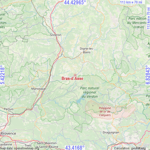
Bras-d’Asse GPS coordinates[2]
43° 55' 31.368" North, 6° 7' 31.08" East
| Map corner | latitude | longitude |
|---|---|---|
| Upper-left | 44.42965°, | 5.42218° |
| Center: | 43.92538°, | 6.1253° |
| Lower-right: | 43.4168°, | 6.82843° |
| Map W x H: | 112.6×112.6 km | = 70×70mi |
| max Lat: | 51.07786° ⇑87.8% North |
| Bras-d’Asse: | 43.92538° |
| min Lat: | ⇓12.2% South 41.3874° |
| min Long | Bras-d’Asse | max Long |
| -5.08615° | 6.1253° | 9.52242° |
| W 88.5%⇐ | ⇒11.5% E |
Elevation
Elevation of Bras-d’Asse is 486 m = 1594 ft, and this is 292.3 m = 959 ft above average elevation for this country.
| Max E: |
2333 m = 7654 ft | 7.6% |
| Bras-d’Asse | 486 m 1594 ft | |
| Avg. | 193.7 m = 635 ft | |
Min E: |
-1 m = -3 ft | 92.4% |
See also: France elevation on elevation.city.
Geographical zone
Bras-d’Asse is located in North temperate zone (between Tropic of Cancer and the Arctic Circle). Distance of this Northern Tropic circle is 2278.1 km =1415.5 mi to South.| Distance of | km | miles | from Bras-d’Asse |
|---|---|---|---|
| North Pole | 5123 | 3183.3 | to North |
| Arctic Circle | 2517.1 | 1564.1 | to North |
| Tropic Cancer | 2278.1 | 1415.5 | to South |
| Equator | 4884 | 3034.8 | to South |


Nearby cities:
15 places around Bras-d’Asse: (largest is in red/bold)
• Barrême
19.7 km =12.2 mi,  80°
80°
• Champtercier
19.1 km =11.9 mi,  8°
8°
• La Brillanne
18.8 km =11.7 mi,  270°
270°
• Les Mées
16.6 km =10.3 mi,  314°
314°
• L’Escale
19.2 km =11.9 mi,  334°
334°
• Malijai
15.4 km =9.6 mi, 330°
• Mallemoisson
13.5 km =8.4 mi,  0°
0°
• Moustiers-Sainte-Marie
11.7 km =7.3 mi,  138°
138°
• Mézel
9.7 km =6 mi,  35°
35°
• Oraison
16.6 km =10.3 mi, 266°
• Peyruis
18.7 km =11.6 mi, 307°
• Puimoisson
7 km =4.3 mi,  178°
178°
• Riez
12.2 km =7.6 mi,  192°
192°
• Roumoules
11.1 km =6.9 mi, 178°
• Valensole
15 km =9.3 mi,  229°
229°
Sources, notices
• [Note1] Compared only with cities in France existing in our database
• [Src1] Map data: © OpenStreetMap contributors (CC-BY-SA)
• [Src2] Other city data from geonames.org with taken over terms of usage.
• [Src3] Geographical zone / Annual Mean Temperature by Robert A. Rohde @ Wikipedia
