Conchy-les-Pots geodata
Conchy-les-Pots (Hauts-de-France) is a populated place; located in France in Europe/Paris (GMT+2) time zone. With population of 612 people, there are 13126 cities with bigger population in this country. Compared to other cities in France, 90.6% of cities are located further ↓South; 53.8% of cities are located further ←West and 57.6% of cities have higher elevation than Conchy-les-Pots. Note1
Administrative division(s):
- Level 1: Hauts-de-France
- Level 2: Département de l'Oise
- Level 3: Arrondissement de Compiègne
- Level 4: Conchy-les-Pots


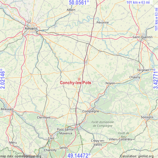
Conchy-les-Pots GPS coordinates[2]
49° 36' 9.144" North, 2° 43' 28.488" East
| Map corner | latitude | longitude |
|---|---|---|
| Upper-left | 50.0561°, | 2.02146° |
| Center: | 49.60254°, | 2.72458° |
| Lower-right: | 49.14472°, | 3.42771° |
| Map W x H: | 101.3×101.3 km | = 62.9×62.9mi |
| max Lat: | 51.07786° ⇑9.4% North |
| Conchy-les-Pots: | 49.60254° |
| min Lat: | ⇓90.6% South 41.3874° |
| min Long | Conchy-les-Pots | max Long |
| -5.08615° | 2.72458° | 9.52242° |
| W 53.8%⇐ | ⇒46.2% E |
Elevation
Elevation of Conchy-les-Pots is 109 m = 358 ft, and this is 84.7 m = 278 ft below average elevation for this country.
| Max E: |
2333 m = 7654 ft | 57.6% |
| Avg. | 193.7 m = 635 ft | |
| Conchy-les-Pots | 109 m = 358 ft | |
Min E: |
-1 m = -3 ft | 42.4% |
See also: France elevation on elevation.city.
Geographical zone
Conchy-les-Pots is located in North temperate zone (between Tropic of Cancer and the Arctic Circle). Distance of this North polar circle is 1885.9 km =1171.8 mi to North.| Distance of | km | miles | from Conchy-les-Pots |
|---|---|---|---|
| North Pole | 4491.8 | 2791.1 | to North |
| Arctic Circle | 1885.9 | 1171.8 | to North |
| Tropic Cancer | 2909.4 | 1807.8 | to South |
| Equator | 5515.3 | 3427 | to South |


Nearby cities:
15 places around Conchy-les-Pots: (largest is in red/bold)
• Beuvraignes
5.8 km =3.6 mi,  33°
33°
• Chevincourt
13.7 km =8.5 mi,  141°
141°
• Cuvilly
5.8 km =3.6 mi,  201°
201°
• Gournay-sur-Aronde
12.8 km =8 mi, 196°
• Lassigny
8.7 km =5.4 mi,  100°
100°
• Mareuil-la-Motte
7.9 km =4.9 mi, 143°
• Montdidier
12.2 km =7.6 mi,  294°
294°
• Méry-la-Bataille
9.3 km =5.8 mi,  227°
227°
• Orvillers-Sorel
3 km =1.9 mi, 203°
• Ressons-sur-Matz
7.3 km =4.5 mi,  168°
168°
• Rollot
5.3 km =3.3 mi,  255°
255°
• Roye
11.8 km =7.3 mi,  23°
23°
• Thiescourt
12.1 km =7.5 mi,  109°
109°
• Tricot
10.9 km =6.8 mi,  244°
244°
• Élincourt-Sainte-Marguerite
10.9 km =6.8 mi, 142°
Sources, notices
• [Note1] Compared only with cities in France existing in our database
• [Src1] Map data: © OpenStreetMap contributors (CC-BY-SA)
• [Src2] Other city data from geonames.org with taken over terms of usage.
• [Src3] Geographical zone / Annual Mean Temperature by Robert A. Rohde @ Wikipedia
