Merléac geodata
Merléac (Brittany) is a populated place; located in France in Europe/Paris (GMT+2) time zone. With population of 532 people, there are 14567 cities with bigger population in this country. Compared to other cities in France, 64.1% of cities are located further ↓South; 97.1% of cities are located further →East and 73.3% of cities have lower elevation than Merléac. Note1
Administrative division(s):
- Level 1: Brittany
- Level 2: Département des Côtes-d’Armor
- Level 3: Arrondissement de Saint-Brieuc
- Level 4: Merléac


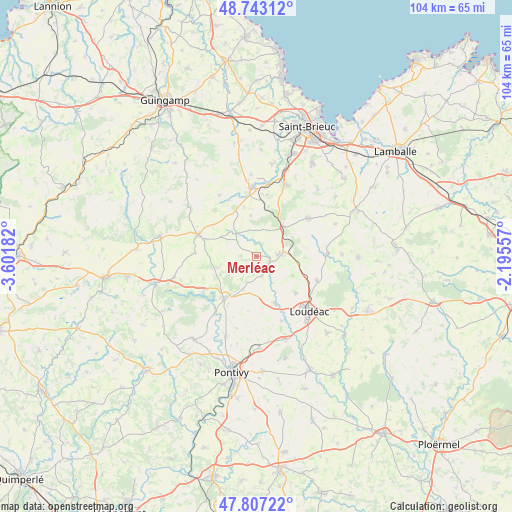
Merléac GPS coordinates[2]
48° 16' 38.316" North, 2° 53' 55.32" West
| Map corner | latitude | longitude |
|---|---|---|
| Upper-left | 48.74312°, | -3.60182° |
| Center: | 48.27731°, | -2.8987° |
| Lower-right: | 47.80722°, | -2.19557° |
| Map W x H: | 104.1×104.1 km | = 64.7×64.7mi |
| max Lat: | 51.07786° ⇑35.9% North |
| Merléac: | 48.27731° |
| min Lat: | ⇓64.1% South 41.3874° |
| min Long | Merléac | max Long |
| -5.08615° | -2.8987° | 9.52242° |
| W 2.9%⇐ | ⇒97.1% E |
Elevation
Elevation of Merléac is 238 m = 781 ft, and this is 44.3 m = 145 ft above average elevation for this country.
| Max E: |
2333 m = 7654 ft | 26.7% |
| Merléac | 238 m 781 ft | |
| Avg. | 193.7 m = 635 ft | |
Min E: |
-1 m = -3 ft | 73.3% |
See also: France elevation on elevation.city.
Geographical zone
Merléac is located in North temperate zone (between Tropic of Cancer and the Arctic Circle). Distance of this North polar circle is 2033.2 km =1263.4 mi to North.| Distance of | km | miles | from Merléac |
|---|---|---|---|
| North Pole | 4639.1 | 2882.6 | to North |
| Arctic Circle | 2033.2 | 1263.4 | to North |
| Tropic Cancer | 2762 | 1716.2 | to South |
| Equator | 5367.9 | 3335.5 | to South |


Nearby cities:
15 places around Merléac: (largest is in red/bold)
• Allineuc
4.2 km =2.6 mi,  27°
27°
• Corlay
12.5 km =7.8 mi,  290°
290°
• Gausson
11 km =6.8 mi,  77°
77°
• La Motte
13.2 km =8.2 mi,  111°
111°
• Le Haut-Corlay
12.6 km =7.8 mi, 292°
• Le Quillio
4.1 km =2.5 mi,  163°
163°
• Mûr-de-Bretagne
10.6 km =6.6 mi,  216°
216°
• Plussulien
12.7 km =7.9 mi,  272°
272°
• Plœuc-sur-Lié
13.6 km =8.5 mi,  53°
53°
• Saint-Aignan
13.7 km =8.5 mi, 218°
• Saint-Brandan
12.7 km =7.9 mi,  10°
10°
• Saint-Caradec
10.1 km =6.3 mi, 156°
• Saint-Mayeux
8.3 km =5.2 mi,  253°
253°
• Trévé
10.7 km =6.6 mi,  133°
133°
• Uzel
4.4 km =2.7 mi,  86°
86°
Sources, notices
• [Note1] Compared only with cities in France existing in our database
• [Src1] Map data: © OpenStreetMap contributors (CC-BY-SA)
• [Src2] Other city data from geonames.org with taken over terms of usage.
• [Src3] Geographical zone / Annual Mean Temperature by Robert A. Rohde @ Wikipedia
