Trévé geodata
Trévé (Brittany) is a populated place; located in France in Europe/Paris (GMT+2) time zone. With population of 1,382 people, there are 6675 cities with bigger population in this country. Compared to other cities in France, 63% of cities are located further ↓South; 96.8% of cities are located further →East and 58% of cities have lower elevation than Trévé. Note1
Administrative division(s):
- Level 1: Brittany
- Level 2: Département des Côtes-d’Armor
- Level 3: Arrondissement de Saint-Brieuc
- Level 4: Trévé


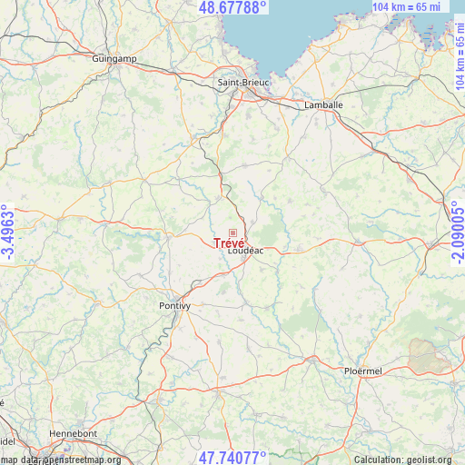
Trévé GPS coordinates[2]
48° 12' 41.292" North, 2° 47' 35.412" West
| Map corner | latitude | longitude |
|---|---|---|
| Upper-left | 48.67788°, | -3.4963° |
| Center: | 48.21147°, | -2.79317° |
| Lower-right: | 47.74077°, | -2.09005° |
| Map W x H: | 104.2×104.2 km | = 64.7×64.7mi |
| max Lat: | 51.07786° ⇑37% North |
| Trévé: | 48.21147° |
| min Lat: | ⇓63% South 41.3874° |
| min Long | Trévé | max Long |
| -5.08615° | -2.79317° | 9.52242° |
| W 3.2%⇐ | ⇒96.8% E |
Elevation
Elevation of Trévé is 161 m = 528 ft, and this is 32.7 m = 107 ft below average elevation for this country.
| Max E: |
2333 m = 7654 ft | 42% |
| Avg. | 193.7 m = 635 ft | |
| Trévé | 161 m = 528 ft | |
Min E: |
-1 m = -3 ft | 58% |
See also: France elevation on elevation.city.
Geographical zone
Trévé is located in North temperate zone (between Tropic of Cancer and the Arctic Circle). Distance of this North polar circle is 2040.6 km =1268 mi to North.| Distance of | km | miles | from Trévé |
|---|---|---|---|
| North Pole | 4646.4 | 2887.1 | to North |
| Arctic Circle | 2040.6 | 1268 | to North |
| Tropic Cancer | 2754.7 | 1711.7 | to South |
| Equator | 5360.6 | 3330.9 | to South |


Nearby cities:
15 places around Trévé: (largest is in red/bold)
• Allineuc
12.5 km =7.8 mi,  332°
332°
• Gausson
10.2 km =6.3 mi,  16°
16°
• Gueltas
12.9 km =8 mi,  181°
181°
• Hémonstoir
6.5 km =4 mi,  205°
205°
• La Motte
5.1 km =3.2 mi,  60°
60°
• La Prénessaye
12.1 km =7.5 mi,  105°
105°
• Langast
12.4 km =7.7 mi,  51°
51°
• Le Quillio
7.5 km =4.7 mi,  296°
296°
• Loudéac
4.7 km =2.9 mi,  142°
142°
• Merléac
10.7 km =6.6 mi,  313°
313°
• Plouguenast
10.2 km =6.3 mi,  39°
39°
• Saint-Barnabé
10.5 km =6.5 mi, 141°
• Saint-Caradec
4.2 km =2.6 mi,  243°
243°
• Saint-Gonnery
9.8 km =6.1 mi,  191°
191°
• Uzel
8.3 km =5.2 mi,  335°
335°
Sources, notices
• [Note1] Compared only with cities in France existing in our database
• [Src1] Map data: © OpenStreetMap contributors (CC-BY-SA)
• [Src2] Other city data from geonames.org with taken over terms of usage.
• [Src3] Geographical zone / Annual Mean Temperature by Robert A. Rohde @ Wikipedia
