Menton geodata
Menton (Provence-Alpes-Côte d'Azur) is a populated place; located in France in Europe/Paris (GMT+2) time zone. With population of 29,649 people, there are 277 cities with bigger population in this country. Compared to other cities in France, 89.4% of cities are located further ↑North; 98% of cities are located further ←West and 95% of cities have higher elevation than Menton. Note1
Administrative division(s):
- Level 1: Provence-Alpes-Côte d'Azur
- Level 2: Alpes-Maritimes
- Level 3: Arrondissement de Nice
- Level 4: Menton


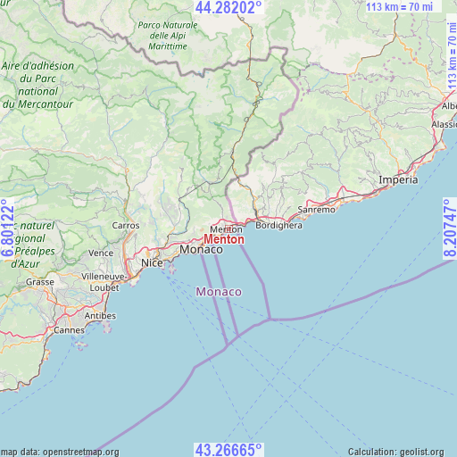
Menton GPS coordinates[2]
43° 46' 35.364" North, 7° 30' 15.66" East
| Map corner | latitude | longitude |
|---|---|---|
| Upper-left | 44.28202°, | 6.80122° |
| Center: | 43.77649°, | 7.50435° |
| Lower-right: | 43.26665°, | 8.20747° |
| Map W x H: | 112.9×112.9 km | = 70.2×70.2mi |
| max Lat: | 51.07786° ⇑89.4% North |
| Menton: | 43.77649° |
| min Lat: | ⇓10.6% South 41.3874° |
| min Long | Menton | max Long |
| -5.08615° | 7.50435° | 9.52242° |
| W 98%⇐ | ⇒2% E |
Elevation
Elevation of Menton is 17 m = 56 ft, and this is 176.7 m = 580 ft below average elevation for this country.
| Max E: |
2333 m = 7654 ft | 95% |
| Avg. | 193.7 m = 635 ft | |
| Menton | 17 m = 56 ft | |
Min E: |
-1 m = -3 ft | 5% |
See also: France elevation on elevation.city.
Geographical zone
Menton is located in North temperate zone (between Tropic of Cancer and the Arctic Circle). Distance of this Northern Tropic circle is 2261.6 km =1405.3 mi to South.| Distance of | km | miles | from Menton |
|---|---|---|---|
| North Pole | 5139.6 | 3193.6 | to North |
| Arctic Circle | 2533.7 | 1574.4 | to North |
| Tropic Cancer | 2261.6 | 1405.3 | to South |
| Equator | 4867.5 | 3024.5 | to South |


Nearby cities:
15 places around Menton: (largest is in red/bold)
• Beausoleil
7.5 km =4.7 mi,  240°
240°
• Blausasc
11.7 km =7.3 mi,  286°
286°
• Cantaron
15.1 km =9.4 mi,  263°
263°
• Cap-d’Ail
10 km =6.2 mi,  232°
232°
• Castellar
3.1 km =1.9 mi,  348°
348°
• Drap
14.9 km =9.3 mi, 260°
• Gorbio
5 km =3.1 mi,  283°
283°
• La Turbie
9 km =5.6 mi,  247°
247°
• L’Escarène
13.6 km =8.5 mi,  298°
298°
• Peille
8.7 km =5.4 mi, 289°
• Peillon
9.8 km =6.1 mi,  271°
271°
• Roquebrune-Cap-Martin
2.3 km =1.4 mi, 232°
• Sainte-Agnès
4.4 km =2.7 mi,  307°
307°
• Sospel
12.2 km =7.6 mi,  338°
338°
• Èze
12.6 km =7.8 mi, 244°
Sources, notices
• [Note1] Compared only with cities in France existing in our database
• [Src1] Map data: © OpenStreetMap contributors (CC-BY-SA)
• [Src2] Other city data from geonames.org with taken over terms of usage.
• [Src3] Geographical zone / Annual Mean Temperature by Robert A. Rohde @ Wikipedia
