Ménesplet geodata
Ménesplet (Nouvelle-Aquitaine) is a populated place; located in France in Europe/Paris (GMT+2) time zone. With population of 1,363 people, there are 6753 cities with bigger population in this country. Compared to other cities in France, 79.5% of cities are located further ↑North; 77% of cities are located further →East and 91.2% of cities have higher elevation than Ménesplet. Note1
Administrative division(s):
- Level 1: Nouvelle-Aquitaine
- Level 2: Dordogne
- Level 3: Arrondissement de Périgueux
- Level 4: Ménesplet


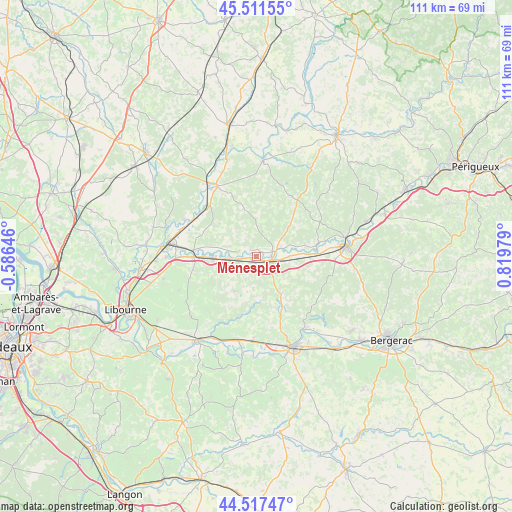
Ménesplet GPS coordinates[2]
45° 1' 0.012" North, 0° 7' 0.012" East
| Map corner | latitude | longitude |
|---|---|---|
| Upper-left | 45.51155°, | -0.58646° |
| Center: | 45.01667°, | 0.11667° |
| Lower-right: | 44.51747°, | 0.81979° |
| Map W x H: | 110.5×110.5 km | = 68.7×68.7mi |
| max Lat: | 51.07786° ⇑79.5% North |
| Ménesplet: | 45.01667° |
| min Lat: | ⇓20.5% South 41.3874° |
| min Long | Ménesplet | max Long |
| -5.08615° | 0.11667° | 9.52242° |
| W 23%⇐ | ⇒77% E |
Elevation
Elevation of Ménesplet is 27 m = 89 ft, and this is 166.7 m = 547 ft below average elevation for this country.
| Max E: |
2333 m = 7654 ft | 91.2% |
| Avg. | 193.7 m = 635 ft | |
| Ménesplet | 27 m = 89 ft | |
Min E: |
-1 m = -3 ft | 8.8% |
See also: France elevation on elevation.city.
Geographical zone
Ménesplet is located in North temperate zone (between Tropic of Cancer and the Arctic Circle). Distance of this North polar circle is 2395.8 km =1488.7 mi to North.| Distance of | km | miles | from Ménesplet |
|---|---|---|---|
| North Pole | 5001.7 | 3107.9 | to North |
| Arctic Circle | 2395.8 | 1488.7 | to North |
| Tropic Cancer | 2399.5 | 1491 | to South |
| Equator | 5005.4 | 3110.2 | to South |


Nearby cities:
15 places around Ménesplet: (largest is in red/bold)
• Chamadelle
17.1 km =10.6 mi,  302°
302°
• La Roche-Chalais
16.8 km =10.4 mi,  332°
332°
• Le Pizou
3.9 km =2.4 mi,  270°
270°
• Les Églisottes-et-Chalaures
15.2 km =9.4 mi,  306°
306°
• Montpon-Ménestérol
4.3 km =2.7 mi,  115°
115°
• Moulin-Neuf
3.9 km =2.4 mi, 270°
• Petit-Palais-et-Cornemps
14.9 km =9.3 mi,  255°
255°
• Porchères
8.1 km =5 mi,  283°
283°
• Puisseguin
17.1 km =10.6 mi,  237°
237°
• Saint-Laurent-des-Hommes
10.6 km =6.6 mi,  79°
79°
• Saint-Martin-de-Gurson
7.1 km =4.4 mi,  185°
185°
• Saint-Méard-de-Gurçon
14 km =8.7 mi,  157°
157°
• Saint-Médard-de-Guizières
13.1 km =8.1 mi, 270°
• Saint-Seurin-sur-l’Isle
9.2 km =5.7 mi, 270°
• Villefranche-de-Lonchat
9.1 km =5.7 mi,  215°
215°
Sources, notices
• [Note1] Compared only with cities in France existing in our database
• [Src1] Map data: © OpenStreetMap contributors (CC-BY-SA)
• [Src2] Other city data from geonames.org with taken over terms of usage.
• [Src3] Geographical zone / Annual Mean Temperature by Robert A. Rohde @ Wikipedia
