Marpent geodata
Marpent (Hauts-de-France) is a populated place; located in France in Europe/Paris (GMT+2) time zone. With population of 2,715 people, there are 3602 cities with bigger population in this country. Compared to other cities in France, 95.5% of cities are located further ↓South; 68.6% of cities are located further ←West and 50.6% of cities have lower elevation than Marpent. Note1
Administrative division(s):
- Level 1: Hauts-de-France
- Level 2: Nord
- Level 3: Avesnes-sur-Helpe
- Level 4: Marpent


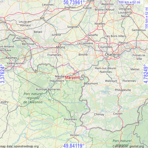
Marpent GPS coordinates[2]
50° 17' 33.072" North, 4° 4' 45.696" East
| Map corner | latitude | longitude |
|---|---|---|
| Upper-left | 50.73961°, | 3.37624° |
| Center: | 50.29252°, | 4.07936° |
| Lower-right: | 49.84119°, | 4.78249° |
| Map W x H: | 99.9×99.9 km | = 62.1×62.1mi |
| max Lat: | 51.07786° ⇑4.5% North |
| Marpent: | 50.29252° |
| min Lat: | ⇓95.5% South 41.3874° |
| min Long | Marpent | max Long |
| -5.08615° | 4.07936° | 9.52242° |
| W 68.6%⇐ | ⇒31.4% E |
Elevation
Elevation of Marpent is 134 m = 440 ft, and this is 59.7 m = 196 ft below average elevation for this country.
| Max E: |
2333 m = 7654 ft | 49.4% |
| Avg. | 193.7 m = 635 ft | |
| Marpent | 134 m = 440 ft | |
Min E: |
-1 m = -3 ft | 50.6% |
See also: France elevation on elevation.city.
Geographical zone
Marpent is located in North temperate zone (between Tropic of Cancer and the Arctic Circle). Distance of this North polar circle is 1809.2 km =1124.2 mi to North.| Distance of | km | miles | from Marpent |
|---|---|---|---|
| North Pole | 4415.1 | 2743.4 | to North |
| Arctic Circle | 1809.2 | 1124.2 | to North |
| Tropic Cancer | 2986.1 | 1855.5 | to South |
| Equator | 5592 | 3474.7 | to South |


Nearby cities:
15 places around Marpent: (largest is in red/bold)
• Boussois
2.7 km =1.7 mi,  261°
261°
• Colleret
4 km =2.5 mi,  178°
178°
• Cousolre
7.2 km =4.5 mi,  136°
136°
• Feignies
11.7 km =7.3 mi,  273°
273°
• Ferrière-la-Grande
7.4 km =4.6 mi,  235°
235°
• Hautmont
12.1 km =7.5 mi,  247°
247°
• Jeumont
1.6 km =1 mi,  73°
73°
• La Longueville
15.8 km =9.8 mi, 268°
• Louvroil
8.9 km =5.5 mi, 249°
• Maubeuge
7.7 km =4.8 mi, 258°
• Recquignies
3.1 km =1.9 mi, 252°
• Rousies
5.8 km =3.6 mi, 248°
• Sars-Poteries
14.2 km =8.8 mi,  195°
195°
• Solre-le-Château
13.2 km =8.2 mi, 177°
• Vieux-Mesnil
16.1 km =10 mi, 254°
Sources, notices
• [Note1] Compared only with cities in France existing in our database
• [Src1] Map data: © OpenStreetMap contributors (CC-BY-SA)
• [Src2] Other city data from geonames.org with taken over terms of usage.
• [Src3] Geographical zone / Annual Mean Temperature by Robert A. Rohde @ Wikipedia
