Rousies geodata
Rousies (Hauts-de-France) is a populated place; located in France in Europe/Paris (GMT+2) time zone. With population of 4,459 people, there are 2212 cities with bigger population in this country. Compared to other cities in France, 95.3% of cities are located further ↓South; 67.9% of cities are located further ←West and 50.5% of cities have higher elevation than Rousies. Note1
Administrative division(s):
- Level 1: Hauts-de-France
- Level 2: Nord
- Level 3: Avesnes-sur-Helpe
- Level 4: Rousies


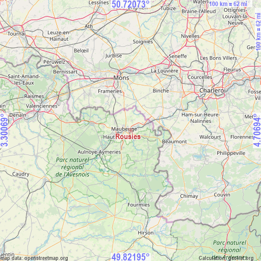
Rousies GPS coordinates[2]
50° 16' 24.456" North, 4° 0' 13.752" East
| Map corner | latitude | longitude |
|---|---|---|
| Upper-left | 50.72073°, | 3.30069° |
| Center: | 50.27346°, | 4.00382° |
| Lower-right: | 49.82195°, | 4.70694° |
| Map W x H: | 99.9×99.9 km | = 62.1×62.1mi |
| max Lat: | 51.07786° ⇑4.7% North |
| Rousies: | 50.27346° |
| min Lat: | ⇓95.3% South 41.3874° |
| min Long | Rousies | max Long |
| -5.08615° | 4.00382° | 9.52242° |
| W 67.9%⇐ | ⇒32.1% E |
Elevation
Elevation of Rousies is 130 m = 427 ft, and this is 63.7 m = 209 ft below average elevation for this country.
| Max E: |
2333 m = 7654 ft | 50.5% |
| Avg. | 193.7 m = 635 ft | |
| Rousies | 130 m = 427 ft | |
Min E: |
-1 m = -3 ft | 49.5% |
See also: France elevation on elevation.city.
Geographical zone
Rousies is located in North temperate zone (between Tropic of Cancer and the Arctic Circle). Distance of this North polar circle is 1811.3 km =1125.5 mi to North.| Distance of | km | miles | from Rousies |
|---|---|---|---|
| North Pole | 4417.2 | 2744.7 | to North |
| Arctic Circle | 1811.3 | 1125.5 | to North |
| Tropic Cancer | 2984 | 1854.2 | to South |
| Equator | 5589.9 | 3473.4 | to South |


Nearby cities:
15 places around Rousies: (largest is in red/bold)
• Bachant
11.6 km =7.2 mi,  236°
236°
• Boussois
3.2 km =2 mi,  56°
56°
• Colleret
5.8 km =3.6 mi,  108°
108°
• Cousolre
10.8 km =6.7 mi, 106°
• Feignies
6.9 km =4.3 mi,  293°
293°
• Ferrière-la-Grande
2.2 km =1.4 mi,  200°
200°
• Hautmont
6.4 km =4 mi,  246°
246°
• Jeumont
7.4 km =4.6 mi,  69°
69°
• La Longueville
10.6 km =6.6 mi,  279°
279°
• Louvroil
3.1 km =1.9 mi, 250°
• Marpent
5.8 km =3.6 mi, 68°
• Maubeuge
2.3 km =1.4 mi, 284°
• Recquignies
2.6 km =1.6 mi, 63°
• Sars-Poteries
11.7 km =7.3 mi,  171°
171°
• Vieux-Mesnil
10.4 km =6.5 mi,  257°
257°
Sources, notices
• [Note1] Compared only with cities in France existing in our database
• [Src1] Map data: © OpenStreetMap contributors (CC-BY-SA)
• [Src2] Other city data from geonames.org with taken over terms of usage.
• [Src3] Geographical zone / Annual Mean Temperature by Robert A. Rohde @ Wikipedia
