Ferrière-la-Grande geodata
Ferrière-la-Grande (Hauts-de-France) is a populated place; located in France in Europe/Paris (GMT+2) time zone. With population of 5,834 people, there are 1690 cities with bigger population in this country. Compared to other cities in France, 95.1% of cities are located further ↓South; 67.7% of cities are located further ←West and 52.2% of cities have lower elevation than Ferrière-la-Grande. Note1
Administrative division(s):
- Level 1: Hauts-de-France
- Level 2: Nord
- Level 3: Avesnes-sur-Helpe
- Level 4: Ferrière-la-Grande


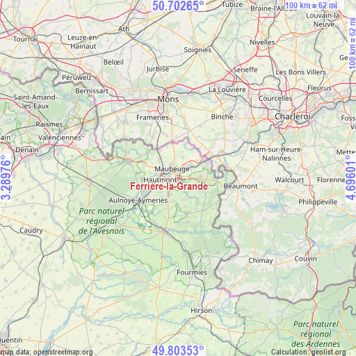
Ferrière-la-Grande GPS coordinates[2]
50° 15' 18.756" North, 3° 59' 34.368" East
| Map corner | latitude | longitude |
|---|---|---|
| Upper-left | 50.70265°, | 3.28976° |
| Center: | 50.25521°, | 3.99288° |
| Lower-right: | 49.80353°, | 4.69601° |
| Map W x H: | 100×100 km | = 62.1×62.1mi |
| max Lat: | 51.07786° ⇑4.9% North |
| Ferrière-la-Grande: | 50.25521° |
| min Lat: | ⇓95.1% South 41.3874° |
| min Long | Ferrière-la-Gr | max Long |
| -5.08615° | 3.99288° | 9.52242° |
| W 67.7%⇐ | ⇒32.3% E |
Elevation
Elevation of Ferrière-la-Grande is 140 m = 459 ft, and this is 53.7 m = 176 ft below average elevation for this country.
| Max E: |
2333 m = 7654 ft | 47.8% |
| Avg. | 193.7 m = 635 ft | |
| Ferrière-la-Grande | 140 m = 459 ft | |
Min E: |
-1 m = -3 ft | 52.2% |
See also: France elevation on elevation.city.
Geographical zone
Ferrière-la-Grande is located in North temperate zone (between Tropic of Cancer and the Arctic Circle). Distance of this North polar circle is 1813.3 km =1126.7 mi to North.| Distance of | km | miles | from Ferrière-la-Grande |
|---|---|---|---|
| North Pole | 4419.2 | 2746 | to North |
| Arctic Circle | 1813.3 | 1126.7 | to North |
| Tropic Cancer | 2981.9 | 1852.9 | to South |
| Equator | 5587.9 | 3472.2 | to South |


Nearby cities:
15 places around Ferrière-la-Grande: (largest is in red/bold)
• Bachant
9.9 km =6.2 mi,  243°
243°
• Boussois
5.1 km =3.2 mi,  42°
42°
• Colleret
6.3 km =3.9 mi,  88°
88°
• Feignies
7.3 km =4.5 mi,  310°
310°
• Hautmont
5.1 km =3.2 mi,  264°
264°
• Jeumont
9 km =5.6 mi,  59°
59°
• La Longueville
10.4 km =6.5 mi,  291°
291°
• Louvroil
2.4 km =1.5 mi,  295°
295°
• Marpent
7.4 km =4.6 mi, 55°
• Maubeuge
3 km =1.9 mi,  331°
331°
• Pont-sur-Sambre
11 km =6.8 mi,  250°
250°
• Recquignies
4.5 km =2.8 mi, 44°
• Rousies
2.2 km =1.4 mi,  20°
20°
• Sars-Poteries
9.9 km =6.2 mi,  165°
165°
• Vieux-Mesnil
9.4 km =5.8 mi,  268°
268°
Sources, notices
• [Note1] Compared only with cities in France existing in our database
• [Src1] Map data: © OpenStreetMap contributors (CC-BY-SA)
• [Src2] Other city data from geonames.org with taken over terms of usage.
• [Src3] Geographical zone / Annual Mean Temperature by Robert A. Rohde @ Wikipedia
