Marlenheim geodata
Marlenheim (Grand Est) is a populated place; located in France in Europe/Paris (GMT+2) time zone. With population of 3,559 people, there are 2737 cities with bigger population in this country. Compared to other cities in France, 71.4% of cities are located further ↓South; 97.9% of cities are located further ←West and 64.6% of cities have lower elevation than Marlenheim. Note1
Administrative division(s):
- Level 1: Grand Est
- Level 2: Bas-Rhin
- Level 3: Arrondissement de Molsheim
- Level 4: Marlenheim


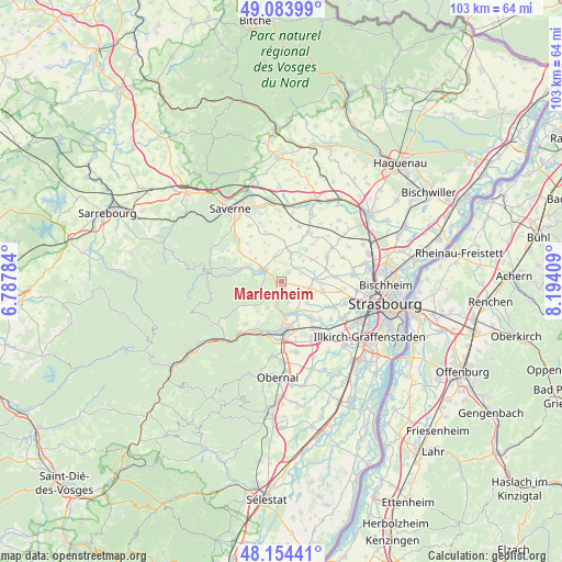
Marlenheim GPS coordinates[2]
48° 37' 16.824" North, 7° 29' 27.456" East
| Map corner | latitude | longitude |
|---|---|---|
| Upper-left | 49.08399°, | 6.78784° |
| Center: | 48.62134°, | 7.49096° |
| Lower-right: | 48.15441°, | 8.19409° |
| Map W x H: | 103.4×103.4 km | = 64.2×64.2mi |
| max Lat: | 51.07786° ⇑28.6% North |
| Marlenheim: | 48.62134° |
| min Lat: | ⇓71.4% South 41.3874° |
| min Long | Marlenheim | max Long |
| -5.08615° | 7.49096° | 9.52242° |
| W 97.9%⇐ | ⇒2.1% E |
Elevation
Elevation of Marlenheim is 192 m = 630 ft, and this is 1.7 m = 6 ft below average elevation for this country.
| Max E: |
2333 m = 7654 ft | 35.4% |
| Avg. | 193.7 m = 635 ft | |
| Marlenheim | 192 m = 630 ft | |
Min E: |
-1 m = -3 ft | 64.6% |
See also: France elevation on elevation.city.
Geographical zone
Marlenheim is located in North temperate zone (between Tropic of Cancer and the Arctic Circle). Distance of this North polar circle is 1995 km =1239.6 mi to North.| Distance of | km | miles | from Marlenheim |
|---|---|---|---|
| North Pole | 4600.9 | 2858.9 | to North |
| Arctic Circle | 1995 | 1239.6 | to North |
| Tropic Cancer | 2800.3 | 1740 | to South |
| Equator | 5406.2 | 3359.3 | to South |


Nearby cities:
15 places around Marlenheim: (largest is in red/bold)
• Bergbieten
5.6 km =3.5 mi,  206°
206°
• Dahlenheim
4.1 km =2.5 mi,  163°
163°
• Furdenheim
5.3 km =3.3 mi,  102°
102°
• Hohengœft
4.6 km =2.9 mi,  344°
344°
• Irmstett
3.8 km =2.4 mi,  194°
194°
• Ittlenheim
5.5 km =3.4 mi,  47°
47°
• Kirchheim
1.4 km =0.9 mi, 163°
• Kuttolsheim
3.5 km =2.2 mi, 45°
• Nordheim
2 km =1.2 mi,  39°
39°
• Soultz-les-Bains
5.5 km =3.4 mi,  183°
183°
• Traenheim
3.4 km =2.1 mi, 213°
• Wangen
1.8 km =1.1 mi,  259°
259°
• Wasselonne
3.8 km =2.4 mi,  298°
298°
• Westhoffen
4.1 km =2.5 mi,  240°
240°
• Willgottheim
5.7 km =3.5 mi,  15°
15°
Sources, notices
• [Note1] Compared only with cities in France existing in our database
• [Src1] Map data: © OpenStreetMap contributors (CC-BY-SA)
• [Src2] Other city data from geonames.org with taken over terms of usage.
• [Src3] Geographical zone / Annual Mean Temperature by Robert A. Rohde @ Wikipedia
