Wasselonne geodata
Wasselonne (Grand Est) is a populated place; located in France in Europe/Paris (GMT+2) time zone. With population of 5,844 people, there are 1688 cities with bigger population in this country. Compared to other cities in France, 71.8% of cities are located further ↓South; 97.6% of cities are located further ←West and 66.2% of cities have lower elevation than Wasselonne. Note1
Administrative division(s):
- Level 1: Grand Est
- Level 2: Bas-Rhin
- Level 3: Arrondissement de Molsheim
- Level 4: Wasselonne


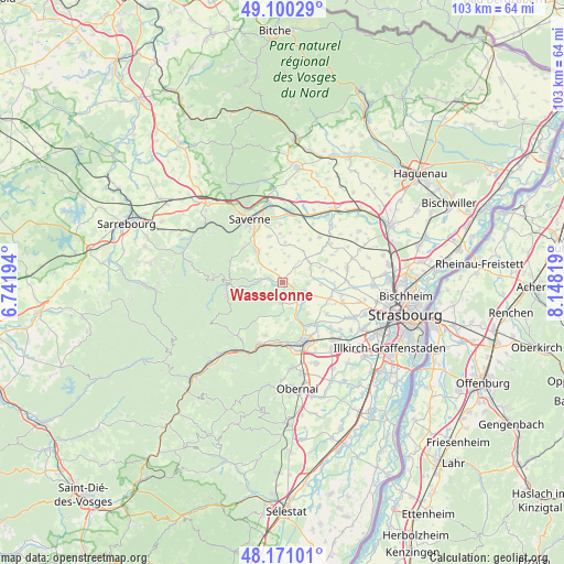
Wasselonne GPS coordinates[2]
48° 38' 16.044" North, 7° 26' 42.216" East
| Map corner | latitude | longitude |
|---|---|---|
| Upper-left | 49.10029°, | 6.74194° |
| Center: | 48.63779°, | 7.44506° |
| Lower-right: | 48.17101°, | 8.14819° |
| Map W x H: | 103.3×103.3 km | = 64.2×64.2mi |
| max Lat: | 51.07786° ⇑28.2% North |
| Wasselonne: | 48.63779° |
| min Lat: | ⇓71.8% South 41.3874° |
| min Long | Wasselonne | max Long |
| -5.08615° | 7.44506° | 9.52242° |
| W 97.6%⇐ | ⇒2.4% E |
Elevation
Elevation of Wasselonne is 200 m = 656 ft, and this is 6.3 m = 21 ft above average elevation for this country.
| Max E: |
2333 m = 7654 ft | 33.8% |
| Wasselonne | 200 m 656 ft | |
| Avg. | 193.7 m = 635 ft | |
Min E: |
-1 m = -3 ft | 66.2% |
See also: France elevation on elevation.city.
Geographical zone
Wasselonne is located in North temperate zone (between Tropic of Cancer and the Arctic Circle). Distance of this North polar circle is 1993.2 km =1238.5 mi to North.| Distance of | km | miles | from Wasselonne |
|---|---|---|---|
| North Pole | 4599 | 2857.7 | to North |
| Arctic Circle | 1993.2 | 1238.5 | to North |
| Tropic Cancer | 2802.1 | 1741.1 | to South |
| Equator | 5408 | 3360.4 | to South |


Nearby cities:
15 places around Wasselonne: (largest is in red/bold)
• Bergbieten
6.9 km =4.3 mi,  172°
172°
• Cosswiller
3.3 km =2.1 mi,  257°
257°
• Dahlenheim
7.3 km =4.5 mi,  141°
141°
• Hohengœft
3.4 km =2.1 mi,  38°
38°
• Irmstett
6.1 km =3.8 mi,  156°
156°
• Kirchheim
4.9 km =3 mi,  130°
130°
• Kuttolsheim
5.9 km =3.7 mi,  83°
83°
• Marlenheim
3.8 km =2.4 mi,  118°
118°
• Marmoutier
7.4 km =4.6 mi,  321°
321°
• Nordheim
4.6 km =2.9 mi,  93°
93°
• Romanswiller
2.9 km =1.8 mi,  287°
287°
• Traenheim
4.9 km =3 mi, 162°
• Wangen
2.7 km =1.7 mi, 143°
• Westhoffen
3.8 km =2.4 mi,  182°
182°
• Willgottheim
6.1 km =3.8 mi,  53°
53°
Sources, notices
• [Note1] Compared only with cities in France existing in our database
• [Src1] Map data: © OpenStreetMap contributors (CC-BY-SA)
• [Src2] Other city data from geonames.org with taken over terms of usage.
• [Src3] Geographical zone / Annual Mean Temperature by Robert A. Rohde @ Wikipedia
