Bergbieten geodata
Bergbieten (Grand Est) is a populated place; located in France in Europe/Paris (GMT+2) time zone. With population of 548 people, there are 14246 cities with bigger population in this country. Compared to other cities in France, 70.3% of cities are located further ↓South; 97.6% of cities are located further ←West and 64% of cities have lower elevation than Bergbieten. Note1
Administrative division(s):
- Level 1: Grand Est
- Level 2: Bas-Rhin
- Level 3: Arrondissement de Molsheim
- Level 4: Bergbieten


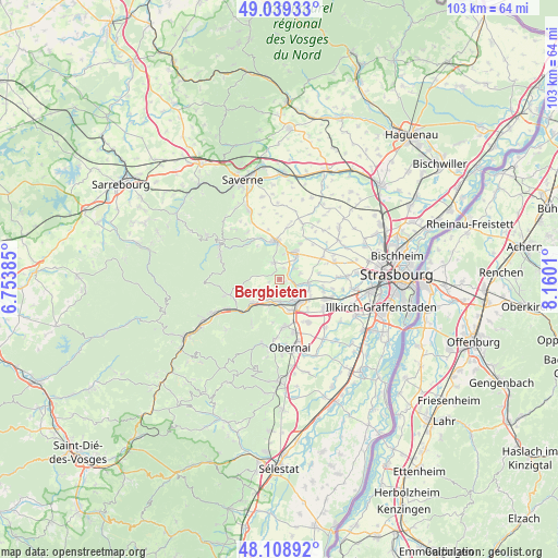
Bergbieten GPS coordinates[2]
48° 34' 34.572" North, 7° 27' 25.092" East
| Map corner | latitude | longitude |
|---|---|---|
| Upper-left | 49.03933°, | 6.75385° |
| Center: | 48.57627°, | 7.45697° |
| Lower-right: | 48.10892°, | 8.1601° |
| Map W x H: | 103.5×103.5 km | = 64.3×64.3mi |
| max Lat: | 51.07786° ⇑29.7% North |
| Bergbieten: | 48.57627° |
| min Lat: | ⇓70.3% South 41.3874° |
| min Long | Bergbieten | max Long |
| -5.08615° | 7.45697° | 9.52242° |
| W 97.6%⇐ | ⇒2.4% E |
Elevation
Elevation of Bergbieten is 189 m = 620 ft, and this is 4.7 m = 15 ft below average elevation for this country.
| Max E: |
2333 m = 7654 ft | 36% |
| Avg. | 193.7 m = 635 ft | |
| Bergbieten | 189 m = 620 ft | |
Min E: |
-1 m = -3 ft | 64% |
See also: France elevation on elevation.city.
Geographical zone
Bergbieten is located in North temperate zone (between Tropic of Cancer and the Arctic Circle). Distance of this North polar circle is 2000 km =1242.7 mi to North.| Distance of | km | miles | from Bergbieten |
|---|---|---|---|
| North Pole | 4605.9 | 2862 | to North |
| Arctic Circle | 2000 | 1242.7 | to North |
| Tropic Cancer | 2795.3 | 1736.9 | to South |
| Equator | 5401.2 | 3356.1 | to South |


Nearby cities:
15 places around Bergbieten: (largest is in red/bold)
• Avolsheim
3.6 km =2.2 mi,  117°
117°
• Dahlenheim
3.8 km =2.4 mi,  73°
73°
• Dangolsheim
0.8 km =0.5 mi,  130°
130°
• Dinsheim-sur-Bruche
4.3 km =2.7 mi,  210°
210°
• Gresswiller
4.9 km =3 mi,  201°
201°
• Irmstett
2 km =1.2 mi,  50°
50°
• Kirchheim
4.7 km =2.9 mi,  38°
38°
• Molsheim
4.7 km =2.9 mi,  147°
147°
• Mutzig
4.1 km =2.5 mi,  181°
181°
• Soultz-les-Bains
2.2 km =1.4 mi,  103°
103°
• Still
4.9 km =3 mi,  232°
232°
• Traenheim
2.2 km =1.4 mi,  16°
16°
• Wangen
4.7 km =2.9 mi,  8°
8°
• Westhoffen
3.2 km =2 mi,  341°
341°
• Wolxheim
4.1 km =2.5 mi, 101°
Sources, notices
• [Note1] Compared only with cities in France existing in our database
• [Src1] Map data: © OpenStreetMap contributors (CC-BY-SA)
• [Src2] Other city data from geonames.org with taken over terms of usage.
• [Src3] Geographical zone / Annual Mean Temperature by Robert A. Rohde @ Wikipedia
