Traenheim geodata
Traenheim (Grand Est) is a populated place; located in France in Europe/Paris (GMT+2) time zone. With population of 600 people, there are 13316 cities with bigger population in this country. Compared to other cities in France, 70.7% of cities are located further ↓South; 97.7% of cities are located further ←West and 65.6% of cities have lower elevation than Traenheim. Note1
Administrative division(s):
- Level 1: Grand Est
- Level 2: Bas-Rhin
- Level 3: Arrondissement de Molsheim
- Level 4: Traenheim


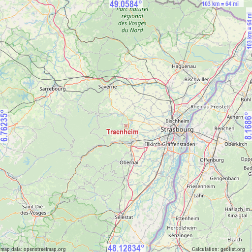
Traenheim GPS coordinates[2]
48° 35' 43.836" North, 7° 27' 55.692" East
| Map corner | latitude | longitude |
|---|---|---|
| Upper-left | 49.0584°, | 6.76235° |
| Center: | 48.59551°, | 7.46547° |
| Lower-right: | 48.12834°, | 8.1686° |
| Map W x H: | 103.4×103.4 km | = 64.2×64.2mi |
| max Lat: | 51.07786° ⇑29.3% North |
| Traenheim: | 48.59551° |
| min Lat: | ⇓70.7% South 41.3874° |
| min Long | Traenheim | max Long |
| -5.08615° | 7.46547° | 9.52242° |
| W 97.7%⇐ | ⇒2.3% E |
Elevation
Elevation of Traenheim is 197 m = 646 ft, and this is 3.3 m = 11 ft above average elevation for this country.
| Max E: |
2333 m = 7654 ft | 34.4% |
| Traenheim | 197 m 646 ft | |
| Avg. | 193.7 m = 635 ft | |
Min E: |
-1 m = -3 ft | 65.6% |
See also: France elevation on elevation.city.
Geographical zone
Traenheim is located in North temperate zone (between Tropic of Cancer and the Arctic Circle). Distance of this North polar circle is 1997.9 km =1241.4 mi to North.| Distance of | km | miles | from Traenheim |
|---|---|---|---|
| North Pole | 4603.7 | 2860.6 | to North |
| Arctic Circle | 1997.9 | 1241.4 | to North |
| Tropic Cancer | 2797.4 | 1738.2 | to South |
| Equator | 5403.3 | 3357.5 | to South |


Nearby cities:
15 places around Traenheim: (largest is in red/bold)
• Avolsheim
4.5 km =2.8 mi,  145°
145°
• Bergbieten
2.2 km =1.4 mi,  196°
196°
• Dachstein
6.2 km =3.9 mi,  127°
127°
• Dahlenheim
3.2 km =2 mi,  109°
109°
• Dangolsheim
2.7 km =1.7 mi,  180°
180°
• Ergersheim
5.4 km =3.4 mi,  121°
121°
• Irmstett
1.3 km =0.8 mi, 131°
• Kirchheim
2.7 km =1.7 mi,  56°
56°
• Marlenheim
3.4 km =2.1 mi,  33°
33°
• Nordheim
5.4 km =3.4 mi,  35°
35°
• Soultz-les-Bains
3.1 km =1.9 mi, 149°
• Wangen
2.5 km =1.6 mi,  2°
2°
• Wasselonne
4.9 km =3 mi,  342°
342°
• Westhoffen
1.9 km =1.2 mi,  298°
298°
• Wolxheim
4.5 km =2.8 mi, 131°
Sources, notices
• [Note1] Compared only with cities in France existing in our database
• [Src1] Map data: © OpenStreetMap contributors (CC-BY-SA)
• [Src2] Other city data from geonames.org with taken over terms of usage.
• [Src3] Geographical zone / Annual Mean Temperature by Robert A. Rohde @ Wikipedia
