Mandray geodata
Mandray (Grand Est) is a populated place; located in France in Europe/Paris (GMT+2) time zone. With population of 608 people, there are 13192 cities with bigger population in this country. Compared to other cities in France, 63.2% of cities are located further ↓South; 94.8% of cities are located further ←West and 89.5% of cities have lower elevation than Mandray. Note1
Administrative division(s):
- Level 1: Grand Est
- Level 2: Vosges
- Level 3: Arrondissement de Saint-Dié-des-Vosges
- Level 4: Mandray


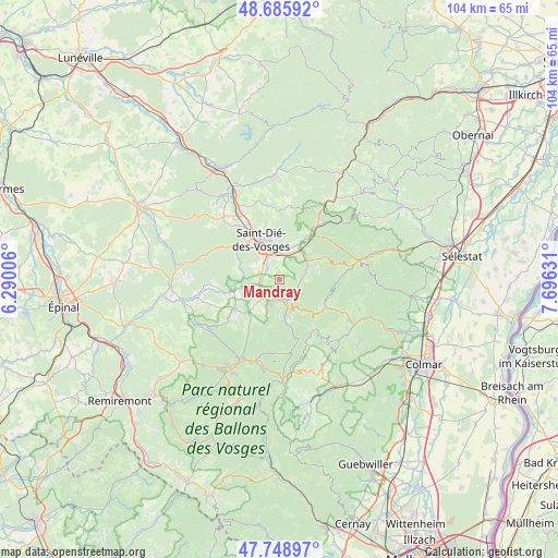
Mandray GPS coordinates[2]
48° 13' 10.524" North, 6° 59' 35.484" East
| Map corner | latitude | longitude |
|---|---|---|
| Upper-left | 48.68592°, | 6.29006° |
| Center: | 48.21959°, | 6.99319° |
| Lower-right: | 47.74897°, | 7.69631° |
| Map W x H: | 104.2×104.2 km | = 64.7×64.7mi |
| max Lat: | 51.07786° ⇑36.8% North |
| Mandray: | 48.21959° |
| min Lat: | ⇓63.2% South 41.3874° |
| min Long | Mandray | max Long |
| -5.08615° | 6.99319° | 9.52242° |
| W 94.8%⇐ | ⇒5.2% E |
Elevation
Elevation of Mandray is 415 m = 1362 ft, and this is 221.3 m = 726 ft above average elevation for this country.
| Max E: |
2333 m = 7654 ft | 10.5% |
| Mandray | 415 m 1362 ft | |
| Avg. | 193.7 m = 635 ft | |
Min E: |
-1 m = -3 ft | 89.5% |
See also: France elevation on elevation.city.
Geographical zone
Mandray is located in North temperate zone (between Tropic of Cancer and the Arctic Circle). Distance of this North polar circle is 2039.7 km =1267.4 mi to North.| Distance of | km | miles | from Mandray |
|---|---|---|---|
| North Pole | 4645.5 | 2886.6 | to North |
| Arctic Circle | 2039.7 | 1267.4 | to North |
| Tropic Cancer | 2755.6 | 1712.2 | to South |
| Equator | 5361.5 | 3331.5 | to South |


Nearby cities:
15 places around Mandray: (largest is in red/bold)
• Anould
5.2 km =3.2 mi,  222°
222°
• Ban-de-Laveline
6.1 km =3.8 mi,  62°
62°
• Corcieux
9.8 km =6.1 mi,  237°
237°
• Fraize
3.7 km =2.3 mi,  174°
174°
• Gerbépal
9.4 km =5.8 mi,  214°
214°
• La Croix-aux-Mines
4.1 km =2.5 mi,  90°
90°
• La Houssière
10.8 km =6.7 mi,  255°
255°
• Le Bonhomme
10.5 km =6.5 mi,  120°
120°
• Nayemont-les-Fosses
8.7 km =5.4 mi,  6°
6°
• Plainfaing
5.5 km =3.4 mi,  162°
162°
• Saint-Dié-des-Vosges
7.8 km =4.8 mi,  335°
335°
• Saint-Léonard
3.7 km =2.3 mi, 264°
• Sainte-Marguerite
5.4 km =3.4 mi,  353°
353°
• Saulcy-sur-Meurthe
2.9 km =1.8 mi,  313°
313°
• Taintrux
7.7 km =4.8 mi,  295°
295°
Sources, notices
• [Note1] Compared only with cities in France existing in our database
• [Src1] Map data: © OpenStreetMap contributors (CC-BY-SA)
• [Src2] Other city data from geonames.org with taken over terms of usage.
• [Src3] Geographical zone / Annual Mean Temperature by Robert A. Rohde @ Wikipedia
