Corcieux geodata
Corcieux (Grand Est) is a populated place; located in France in Europe/Paris (GMT+2) time zone. With population of 1,662 people, there are 5632 cities with bigger population in this country. Compared to other cities in France, 62.3% of cities are located further ↓South; 94.2% of cities are located further ←West and 93.9% of cities have lower elevation than Corcieux. Note1
Administrative division(s):
- Level 1: Grand Est
- Level 2: Vosges
- Level 3: Arrondissement de Saint-Dié-des-Vosges
- Level 4: Corcieux


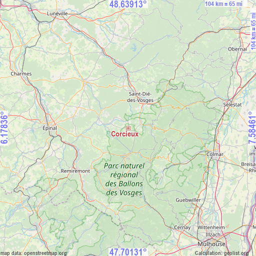
Corcieux GPS coordinates[2]
48° 10' 20.496" North, 6° 52' 53.328" East
| Map corner | latitude | longitude |
|---|---|---|
| Upper-left | 48.63913°, | 6.17836° |
| Center: | 48.17236°, | 6.88148° |
| Lower-right: | 47.70131°, | 7.58461° |
| Map W x H: | 104.3×104.3 km | = 64.8×64.8mi |
| max Lat: | 51.07786° ⇑37.7% North |
| Corcieux: | 48.17236° |
| min Lat: | ⇓62.3% South 41.3874° |
| min Long | Corcieux | max Long |
| -5.08615° | 6.88148° | 9.52242° |
| W 94.2%⇐ | ⇒5.8% E |
Elevation
Elevation of Corcieux is 538 m = 1765 ft, and this is 344.3 m = 1130 ft above average elevation for this country.
| Max E: |
2333 m = 7654 ft | 6.1% |
| Corcieux | 538 m 1765 ft | |
| Avg. | 193.7 m = 635 ft | |
Min E: |
-1 m = -3 ft | 93.9% |
See also: France elevation on elevation.city.
Geographical zone
Corcieux is located in North temperate zone (between Tropic of Cancer and the Arctic Circle). Distance of this North polar circle is 2044.9 km =1270.6 mi to North.| Distance of | km | miles | from Corcieux |
|---|---|---|---|
| North Pole | 4650.8 | 2889.9 | to North |
| Arctic Circle | 2044.9 | 1270.6 | to North |
| Tropic Cancer | 2750.3 | 1709 | to South |
| Equator | 5356.3 | 3328.2 | to South |


Nearby cities:
15 places around Corcieux: (largest is in red/bold)
• Anould
5 km =3.1 mi,  73°
73°
• Bruyères
12.7 km =7.9 mi,  287°
287°
• Champ-le-Duc
12.1 km =7.5 mi,  282°
282°
• Fraize
8.8 km =5.5 mi,  79°
79°
• Gerbépal
3.9 km =2.4 mi,  130°
130°
• Granges-sur-Vologne
7.4 km =4.6 mi,  245°
245°
• Gérardmer
11 km =6.8 mi,  181°
181°
• La Houssière
3.3 km =2.1 mi,  319°
319°
• Laveline-devant-Bruyères
9.4 km =5.8 mi, 281°
• Mandray
9.8 km =6.1 mi,  57°
57°
• Plainfaing
9.9 km =6.2 mi,  89°
89°
• Saint-Léonard
6.7 km =4.2 mi,  43°
43°
• Saulcy-sur-Meurthe
9.5 km =5.9 mi, 40°
• Taintrux
8.7 km =5.4 mi,  8°
8°
• Xonrupt-Longemer
10.6 km =6.6 mi,  160°
160°
Sources, notices
• [Note1] Compared only with cities in France existing in our database
• [Src1] Map data: © OpenStreetMap contributors (CC-BY-SA)
• [Src2] Other city data from geonames.org with taken over terms of usage.
• [Src3] Geographical zone / Annual Mean Temperature by Robert A. Rohde @ Wikipedia
