Sainte-Marguerite geodata
Sainte-Marguerite (Grand Est) is a populated place; located in France in Europe/Paris (GMT+2) time zone. With population of 2,324 people, there are 4157 cities with bigger population in this country. Compared to other cities in France, 64% of cities are located further ↓South; 94.7% of cities are located further ←West and 85.7% of cities have lower elevation than Sainte-Marguerite. Note1
Administrative division(s):
- Level 1: Grand Est
- Level 2: Vosges
- Level 3: Arrondissement de Saint-Dié-des-Vosges
- Level 4: Sainte-Marguerite


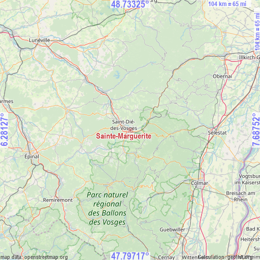
Sainte-Marguerite GPS coordinates[2]
48° 16' 2.46" North, 6° 59' 3.804" East
| Map corner | latitude | longitude |
|---|---|---|
| Upper-left | 48.73325°, | 6.28127° |
| Center: | 48.26735°, | 6.98439° |
| Lower-right: | 47.79717°, | 7.68752° |
| Map W x H: | 104.1×104.1 km | = 64.7×64.7mi |
| max Lat: | 51.07786° ⇑36% North |
| Sainte-Marguerite: | 48.26735° |
| min Lat: | ⇓64% South 41.3874° |
| min Long | Sainte-Margueri | max Long |
| -5.08615° | 6.98439° | 9.52242° |
| W 94.7%⇐ | ⇒5.3% E |
Elevation
Elevation of Sainte-Marguerite is 357 m = 1171 ft, and this is 163.3 m = 536 ft above average elevation for this country.
| Max E: |
2333 m = 7654 ft | 14.3% |
| Sainte-Marguerite | 357 m 1171 ft | |
| Avg. | 193.7 m = 635 ft | |
Min E: |
-1 m = -3 ft | 85.7% |
See also: France elevation on elevation.city.
Geographical zone
Sainte-Marguerite is located in North temperate zone (between Tropic of Cancer and the Arctic Circle). Distance of this North polar circle is 2034.3 km =1264.1 mi to North.| Distance of | km | miles | from Sainte-Marguerite |
|---|---|---|---|
| North Pole | 4640.2 | 2883.3 | to North |
| Arctic Circle | 2034.3 | 1264.1 | to North |
| Tropic Cancer | 2760.9 | 1715.5 | to South |
| Equator | 5366.8 | 3334.8 | to South |


Nearby cities:
15 places around Sainte-Marguerite: (largest is in red/bold)
• Anould
9.6 km =6 mi,  197°
197°
• Ban-de-Laveline
6.5 km =4 mi,  112°
112°
• Colroy-la-Grande
10.8 km =6.7 mi,  59°
59°
• Fraize
9 km =5.6 mi,  173°
173°
• La Croix-aux-Mines
7.1 km =4.4 mi,  138°
138°
• La Voivre
9.3 km =5.8 mi,  319°
319°
• Mandray
5.4 km =3.4 mi, 173°
• Nayemont-les-Fosses
3.7 km =2.3 mi,  26°
26°
• Plainfaing
10.8 km =6.7 mi, 167°
• Provenchères-sur-Fave
8.3 km =5.2 mi, 57°
• Saint-Dié-des-Vosges
3.1 km =1.9 mi,  304°
304°
• Saint-Léonard
6.4 km =4 mi,  208°
208°
• Saint-Michel-sur-Meurthe
9.3 km =5.8 mi,  311°
311°
• Saulcy-sur-Meurthe
3.6 km =2.2 mi, 204°
• Taintrux
6.6 km =4.1 mi,  252°
252°
Sources, notices
• [Note1] Compared only with cities in France existing in our database
• [Src1] Map data: © OpenStreetMap contributors (CC-BY-SA)
• [Src2] Other city data from geonames.org with taken over terms of usage.
• [Src3] Geographical zone / Annual Mean Temperature by Robert A. Rohde @ Wikipedia
