Malrevers geodata
Malrevers (Auvergne-Rhône-Alpes) is a populated place; located in France in Europe/Paris (GMT+2) time zone. With population of 718 people, there are 11561 cities with bigger population in this country. Compared to other cities in France, 78.6% of cities are located further ↑North; 67.5% of cities are located further ←West and 96.1% of cities have lower elevation than Malrevers. Note1
Administrative division(s):
- Level 1: Auvergne-Rhône-Alpes
- Level 2: Haute-Loire
- Level 3: Arrondissement du Puy-en-Velay
- Level 4: Malrevers


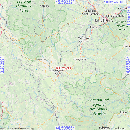
Malrevers GPS coordinates[2]
45° 5' 53.34" North, 3° 57' 58.032" East
| Map corner | latitude | longitude |
|---|---|---|
| Upper-left | 45.59232°, | 3.26299° |
| Center: | 45.09815°, | 3.96612° |
| Lower-right: | 44.59966°, | 4.66924° |
| Map W x H: | 110.4×110.4 km | = 68.6×68.6mi |
| max Lat: | 51.07786° ⇑78.6% North |
| Malrevers: | 45.09815° |
| min Lat: | ⇓21.4% South 41.3874° |
| min Long | Malrevers | max Long |
| -5.08615° | 3.96612° | 9.52242° |
| W 67.5%⇐ | ⇒32.5% E |
Elevation
Elevation of Malrevers is 650 m = 2133 ft, and this is 456.3 m = 1497 ft above average elevation for this country.
| Max E: |
2333 m = 7654 ft | 3.9% |
| Malrevers | 650 m 2133 ft | |
| Avg. | 193.7 m = 635 ft | |
Min E: |
-1 m = -3 ft | 96.1% |
See also: France elevation on elevation.city.
Geographical zone
Malrevers is located in North temperate zone (between Tropic of Cancer and the Arctic Circle). Distance of this North polar circle is 2386.7 km =1483 mi to North.| Distance of | km | miles | from Malrevers |
|---|---|---|---|
| North Pole | 4992.6 | 3102.3 | to North |
| Arctic Circle | 2386.7 | 1483 | to North |
| Tropic Cancer | 2408.5 | 1496.6 | to South |
| Equator | 5014.4 | 3115.8 | to South |


Nearby cities:
15 places around Malrevers: (largest is in red/bold)
• Blavozy
4.7 km =2.9 mi,  166°
166°
• Brives-Charensac
6.3 km =3.9 mi,  207°
207°
• Chadrac
6.4 km =4 mi,  230°
230°
• Chaspinhac
2.2 km =1.4 mi, 231°
• Espaly-Saint-Marcel
9.7 km =6 mi, 234°
• Lavoûte-sur-Loire
5.2 km =3.2 mi,  295°
295°
• Le Puy-en-Velay
8.8 km =5.5 mi, 226°
• Polignac
8.8 km =5.5 mi,  249°
249°
• Rosières
4.2 km =2.6 mi,  24°
24°
• Saint-Germain-Laprade
6.6 km =4.1 mi,  177°
177°
• Saint-Hostien
6.9 km =4.3 mi,  113°
113°
• Saint-Pierre-Eynac
7.8 km =4.8 mi,  137°
137°
• Saint-Vincent
6.8 km =4.2 mi,  318°
318°
• Saint-Étienne-Lardeyrol
4 km =2.5 mi, 137°
• Vals-près-le-Puy
10.1 km =6.3 mi,  223°
223°
Sources, notices
• [Note1] Compared only with cities in France existing in our database
• [Src1] Map data: © OpenStreetMap contributors (CC-BY-SA)
• [Src2] Other city data from geonames.org with taken over terms of usage.
• [Src3] Geographical zone / Annual Mean Temperature by Robert A. Rohde @ Wikipedia
