Rosières geodata
Rosières (Auvergne-Rhône-Alpes) is a populated place; located in France in Europe/Paris (GMT+2) time zone. With population of 1,376 people, there are 6699 cities with bigger population in this country. Compared to other cities in France, 78.2% of cities are located further ↑North; 67.7% of cities are located further ←West and 96.1% of cities have lower elevation than Rosières. Note1
Administrative division(s):
- Level 1: Auvergne-Rhône-Alpes
- Level 2: Haute-Loire
- Level 3: Arrondissement du Puy-en-Velay
- Level 4: Rosières


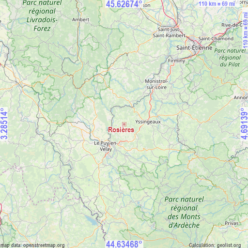
Rosières GPS coordinates[2]
45° 7' 58.332" North, 3° 59' 17.736" East
| Map corner | latitude | longitude |
|---|---|---|
| Upper-left | 45.62674°, | 3.28514° |
| Center: | 45.13287°, | 3.98826° |
| Lower-right: | 44.63468°, | 4.69139° |
| Map W x H: | 110.3×110.3 km | = 68.5×68.5mi |
| max Lat: | 51.07786° ⇑78.2% North |
| Rosières: | 45.13287° |
| min Lat: | ⇓21.8% South 41.3874° |
| min Long | Rosières | max Long |
| -5.08615° | 3.98826° | 9.52242° |
| W 67.7%⇐ | ⇒32.3% E |
Elevation
Elevation of Rosières is 654 m = 2146 ft, and this is 460.3 m = 1510 ft above average elevation for this country.
| Max E: |
2333 m = 7654 ft | 3.9% |
| Rosières | 654 m 2146 ft | |
| Avg. | 193.7 m = 635 ft | |
Min E: |
-1 m = -3 ft | 96.1% |
See also: France elevation on elevation.city.
Geographical zone
Rosières is located in North temperate zone (between Tropic of Cancer and the Arctic Circle). Distance of this North polar circle is 2382.9 km =1480.7 mi to North.| Distance of | km | miles | from Rosières |
|---|---|---|---|
| North Pole | 4988.8 | 3099.9 | to North |
| Arctic Circle | 2382.9 | 1480.7 | to North |
| Tropic Cancer | 2412.4 | 1499 | to South |
| Equator | 5018.3 | 3118.2 | to South |


Nearby cities:
15 places around Rosières: (largest is in red/bold)
• Beaux
10.2 km =6.3 mi,  53°
53°
• Blavozy
8.4 km =5.2 mi,  184°
184°
• Brives-Charensac
10.5 km =6.5 mi,  206°
206°
• Chadrac
10.4 km =6.5 mi,  220°
220°
• Chaspinhac
6.2 km =3.9 mi, 213°
• Lavoûte-sur-Loire
6.7 km =4.2 mi,  255°
255°
• Malrevers
4.2 km =2.6 mi,  204°
204°
• Retournac
8.7 km =5.4 mi,  24°
24°
• Saint-Germain-Laprade
10.6 km =6.6 mi,  187°
187°
• Saint-Hostien
8.1 km =5 mi,  145°
145°
• Saint-Pierre-Eynac
10.2 km =6.3 mi,  159°
159°
• Saint-Vincent
6.3 km =3.9 mi,  281°
281°
• Saint-Étienne-Lardeyrol
6.9 km =4.3 mi,  171°
171°
• Vorey
8.6 km =5.3 mi,  314°
314°
• Yssingeaux
10.7 km =6.6 mi,  84°
84°
Sources, notices
• [Note1] Compared only with cities in France existing in our database
• [Src1] Map data: © OpenStreetMap contributors (CC-BY-SA)
• [Src2] Other city data from geonames.org with taken over terms of usage.
• [Src3] Geographical zone / Annual Mean Temperature by Robert A. Rohde @ Wikipedia
