Malmerspach geodata
Malmerspach (Grand Est) is a populated place; located in France in Europe/Paris (GMT+2) time zone. With population of 581 people, there are 13635 cities with bigger population in this country. Compared to other cities in France, 56.9% of cities are located further ↓South; 95% of cities are located further ←West and 88.3% of cities have lower elevation than Malmerspach. Note1
Administrative division(s):
- Level 1: Grand Est
- Level 2: Haut-Rhin
- Level 3: Arrondissement de Thann-Guebwiller
- Level 4: Malmerspach


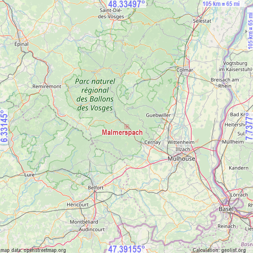
Malmerspach GPS coordinates[2]
47° 51' 55.476" North, 7° 2' 4.488" East
| Map corner | latitude | longitude |
|---|---|---|
| Upper-left | 48.33497°, | 6.33145° |
| Center: | 47.86541°, | 7.03458° |
| Lower-right: | 47.39155°, | 7.7377° |
| Map W x H: | 104.9×104.9 km | = 65.2×65.2mi |
| max Lat: | 51.07786° ⇑43.1% North |
| Malmerspach: | 47.86541° |
| min Lat: | ⇓56.9% South 41.3874° |
| min Long | Malmerspach | max Long |
| -5.08615° | 7.03458° | 9.52242° |
| W 95%⇐ | ⇒5% E |
Elevation
Elevation of Malmerspach is 394 m = 1293 ft, and this is 200.3 m = 657 ft above average elevation for this country.
| Max E: |
2333 m = 7654 ft | 11.7% |
| Malmerspach | 394 m 1293 ft | |
| Avg. | 193.7 m = 635 ft | |
Min E: |
-1 m = -3 ft | 88.3% |
See also: France elevation on elevation.city.
Geographical zone
Malmerspach is located in North temperate zone (between Tropic of Cancer and the Arctic Circle). Distance of this North polar circle is 2079 km =1291.8 mi to North.| Distance of | km | miles | from Malmerspach |
|---|---|---|---|
| North Pole | 4684.9 | 2911.1 | to North |
| Arctic Circle | 2079 | 1291.8 | to North |
| Tropic Cancer | 2716.2 | 1687.8 | to South |
| Equator | 5322.1 | 3307 | to South |


Nearby cities:
15 places around Malmerspach: (largest is in red/bold)
• Bitschwiller-lès-Thann
5.2 km =3.2 mi,  140°
140°
• Fellering
5 km =3.1 mi,  313°
313°
• Husseren-Wesserling
3.9 km =2.4 mi,  301°
301°
• Kirchberg
9.5 km =5.9 mi,  217°
217°
• Kruth
9 km =5.6 mi,  324°
324°
• Leimbach
9.4 km =5.8 mi,  148°
148°
• Moosch
1.2 km =0.7 mi,  118°
118°
• Oderen
6.7 km =4.2 mi, 318°
• Ranspach
2.9 km =1.8 mi, 321°
• Rimbach-près-Masevaux
7.4 km =4.6 mi,  236°
236°
• Roderen
10.2 km =6.3 mi,  156°
156°
• Saint-Amarin
1.1 km =0.7 mi,  339°
339°
• Steinbach
10.1 km =6.3 mi, 119°
• Thann
8.2 km =5.1 mi, 141°
• Vieux-Thann
9.4 km =5.8 mi, 136°
Sources, notices
• [Note1] Compared only with cities in France existing in our database
• [Src1] Map data: © OpenStreetMap contributors (CC-BY-SA)
• [Src2] Other city data from geonames.org with taken over terms of usage.
• [Src3] Geographical zone / Annual Mean Temperature by Robert A. Rohde @ Wikipedia
