Kirchberg geodata
Kirchberg (Grand Est) is a populated place; located in France in Europe/Paris (GMT+2) time zone. With population of 879 people, there are 9827 cities with bigger population in this country. Compared to other cities in France, 55.7% of cities are located further ↓South; 94.6% of cities are located further ←West and 91.2% of cities have lower elevation than Kirchberg. Note1
Administrative division(s):
- Level 1: Grand Est
- Level 2: Haut-Rhin
- Level 3: Arrondissement de Thann-Guebwiller
- Level 4: Kirchberg


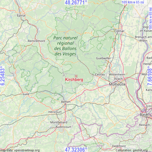
Kirchberg GPS coordinates[2]
47° 47' 51.108" North, 6° 57' 28.62" East
| Map corner | latitude | longitude |
|---|---|---|
| Upper-left | 48.26771°, | 6.25483° |
| Center: | 47.79753°, | 6.95795° |
| Lower-right: | 47.32306°, | 7.66108° |
| Map W x H: | 105×105 km | = 65.2×65.2mi |
| max Lat: | 51.07786° ⇑44.3% North |
| Kirchberg: | 47.79753° |
| min Lat: | ⇓55.7% South 41.3874° |
| min Long | Kirchberg | max Long |
| -5.08615° | 6.95795° | 9.52242° |
| W 94.6%⇐ | ⇒5.4% E |
Elevation
Elevation of Kirchberg is 453 m = 1486 ft, and this is 259.3 m = 851 ft above average elevation for this country.
| Max E: |
2333 m = 7654 ft | 8.8% |
| Kirchberg | 453 m 1486 ft | |
| Avg. | 193.7 m = 635 ft | |
Min E: |
-1 m = -3 ft | 91.2% |
See also: France elevation on elevation.city.
Geographical zone
Kirchberg is located in North temperate zone (between Tropic of Cancer and the Arctic Circle). Distance of this North polar circle is 2086.6 km =1296.6 mi to North.| Distance of | km | miles | from Kirchberg |
|---|---|---|---|
| North Pole | 4692.5 | 2915.8 | to North |
| Arctic Circle | 2086.6 | 1296.6 | to North |
| Tropic Cancer | 2708.7 | 1683.1 | to South |
| Equator | 5314.6 | 3302.3 | to South |


Nearby cities:
15 places around Kirchberg: (largest is in red/bold)
• Bitschwiller-lès-Thann
9.7 km =6 mi,  68°
68°
• Bourbach-le-Bas
7.9 km =4.9 mi,  108°
108°
• Grosmagny
9.9 km =6.2 mi,  213°
213°
• Husseren-Wesserling
9.9 km =6.2 mi,  14°
14°
• Lauw
6.4 km =4 mi,  135°
135°
• Malmerspach
9.5 km =5.9 mi,  37°
37°
• Masevaux
3.7 km =2.3 mi,  128°
128°
• Moosch
9.7 km =6 mi, 44°
• Rimbach-près-Masevaux
3.4 km =2.1 mi,  352°
352°
• Roderen
10 km =6.2 mi,  100°
100°
• Rougemont-le-Château
6.9 km =4.3 mi,  174°
174°
• Saint-Amarin
10.1 km =6.3 mi,  31°
31°
• Sentheim
8.5 km =5.3 mi,  123°
123°
• Sewen
4 km =2.5 mi,  285°
285°
• Vescemont
10.4 km =6.5 mi,  235°
235°
Sources, notices
• [Note1] Compared only with cities in France existing in our database
• [Src1] Map data: © OpenStreetMap contributors (CC-BY-SA)
• [Src2] Other city data from geonames.org with taken over terms of usage.
• [Src3] Geographical zone / Annual Mean Temperature by Robert A. Rohde @ Wikipedia
