Oderen geodata
Oderen (Grand Est) is a populated place; located in France in Europe/Paris (GMT+2) time zone. With population of 1,378 people, there are 6687 cities with bigger population in this country. Compared to other cities in France, 57.7% of cities are located further ↓South; 94.7% of cities are located further ←West and 91.7% of cities have lower elevation than Oderen. Note1
Administrative division(s):
- Level 1: Grand Est
- Level 2: Haut-Rhin
- Level 3: Arrondissement de Thann-Guebwiller
- Level 4: Oderen


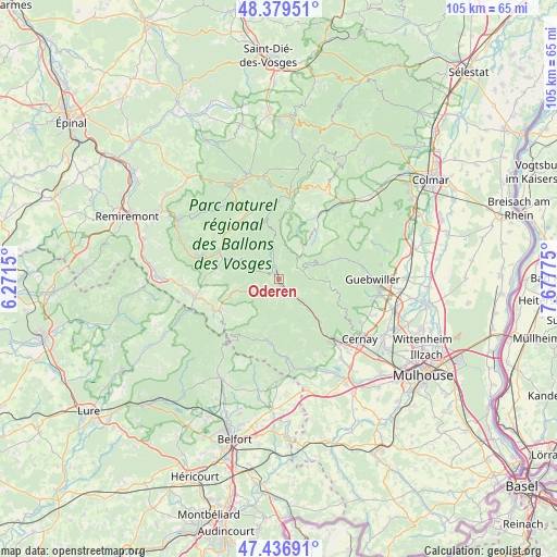
Oderen GPS coordinates[2]
47° 54' 37.296" North, 6° 58' 28.668" East
| Map corner | latitude | longitude |
|---|---|---|
| Upper-left | 48.37951°, | 6.2715° |
| Center: | 47.91036°, | 6.97463° |
| Lower-right: | 47.43691°, | 7.67775° |
| Map W x H: | 104.8×104.8 km | = 65.1×65.1mi |
| max Lat: | 51.07786° ⇑42.3% North |
| Oderen: | 47.91036° |
| min Lat: | ⇓57.7% South 41.3874° |
| min Long | Oderen | max Long |
| -5.08615° | 6.97463° | 9.52242° |
| W 94.7%⇐ | ⇒5.3% E |
Elevation
Elevation of Oderen is 467 m = 1532 ft, and this is 273.3 m = 897 ft above average elevation for this country.
| Max E: |
2333 m = 7654 ft | 8.3% |
| Oderen | 467 m 1532 ft | |
| Avg. | 193.7 m = 635 ft | |
Min E: |
-1 m = -3 ft | 91.7% |
See also: France elevation on elevation.city.
Geographical zone
Oderen is located in North temperate zone (between Tropic of Cancer and the Arctic Circle). Distance of this North polar circle is 2074 km =1288.7 mi to North.| Distance of | km | miles | from Oderen |
|---|---|---|---|
| North Pole | 4679.9 | 2908 | to North |
| Arctic Circle | 2074 | 1288.7 | to North |
| Tropic Cancer | 2721.2 | 1690.9 | to South |
| Equator | 5327.1 | 3310.1 | to South |


Nearby cities:
15 places around Oderen: (largest is in red/bold)
• Bitschwiller-lès-Thann
11.9 km =7.4 mi,  139°
139°
• Bussang
9.5 km =5.9 mi,  252°
252°
• Cornimont
12.1 km =7.5 mi,  297°
297°
• Fellering
1.7 km =1.1 mi,  152°
152°
• Husseren-Wesserling
3.2 km =2 mi,  159°
159°
• Kirchberg
12.6 km =7.8 mi,  185°
185°
• Kruth
2.4 km =1.5 mi,  342°
342°
• Linthal
12.2 km =7.6 mi,  67°
67°
• Malmerspach
6.7 km =4.2 mi, 138°
• Moosch
7.8 km =4.8 mi, 135°
• Ranspach
3.8 km =2.4 mi, 135°
• Rimbach-près-Masevaux
9.3 km =5.8 mi, 190°
• Saint-Amarin
5.7 km =3.5 mi,  133°
133°
• Sondernach
12.3 km =7.6 mi,  37°
37°
• Ventron
8.4 km =5.2 mi,  292°
292°
Sources, notices
• [Note1] Compared only with cities in France existing in our database
• [Src1] Map data: © OpenStreetMap contributors (CC-BY-SA)
• [Src2] Other city data from geonames.org with taken over terms of usage.
• [Src3] Geographical zone / Annual Mean Temperature by Robert A. Rohde @ Wikipedia
