Lusignan geodata
Lusignan (Nouvelle-Aquitaine) is a populated place; located in France in Europe/Paris (GMT+2) time zone. With population of 2,871 people, there are 3402 cities with bigger population in this country. Compared to other cities in France, 60.7% of cities are located further ↑North; 77% of cities are located further →East and 54.1% of cities have higher elevation than Lusignan. Note1
Administrative division(s):
- Level 1: Nouvelle-Aquitaine
- Level 2: Vienne
- Level 3: Arrondissement de Poitiers
- Level 4: Lusignan


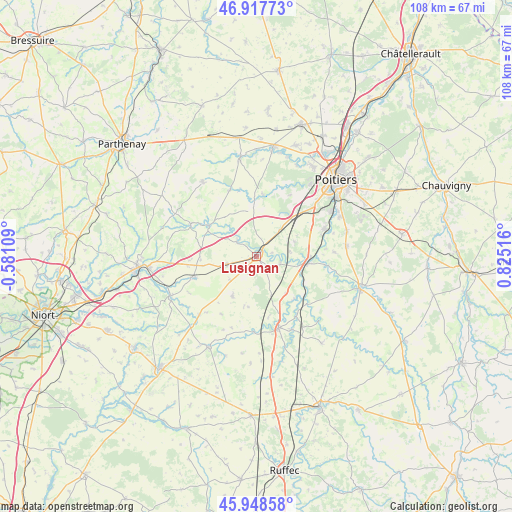
Lusignan GPS coordinates[2]
46° 26' 7.116" North, 0° 7' 19.344" East
| Map corner | latitude | longitude |
|---|---|---|
| Upper-left | 46.91773°, | -0.58109° |
| Center: | 46.43531°, | 0.12204° |
| Lower-right: | 45.94858°, | 0.82516° |
| Map W x H: | 107.8×107.8 km | = 67×67mi |
| max Lat: | 51.07786° ⇑60.7% North |
| Lusignan: | 46.43531° |
| min Lat: | ⇓39.3% South 41.3874° |
| min Long | Lusignan | max Long |
| -5.08615° | 0.12204° | 9.52242° |
| W 23%⇐ | ⇒77% E |
Elevation
Elevation of Lusignan is 119 m = 390 ft, and this is 74.7 m = 245 ft below average elevation for this country.
| Max E: |
2333 m = 7654 ft | 54.1% |
| Avg. | 193.7 m = 635 ft | |
| Lusignan | 119 m = 390 ft | |
Min E: |
-1 m = -3 ft | 45.9% |
See also: France elevation on elevation.city.
Geographical zone
Lusignan is located in North temperate zone (between Tropic of Cancer and the Arctic Circle). Distance of this North polar circle is 2238.1 km =1390.7 mi to North.| Distance of | km | miles | from Lusignan |
|---|---|---|---|
| North Pole | 4843.9 | 3009.9 | to North |
| Arctic Circle | 2238.1 | 1390.7 | to North |
| Tropic Cancer | 2557.2 | 1589 | to South |
| Equator | 5163.1 | 3208.2 | to South |


Nearby cities:
15 places around Lusignan: (largest is in red/bold)
• Benassay
14.9 km =9.3 mi,  337°
337°
• Celle-Lévescault
5.2 km =3.2 mi,  104°
104°
• Château-Larcher
14.8 km =9.2 mi, 97°
• Coulombiers
7.5 km =4.7 mi,  41°
41°
• Jazeneuil
5.3 km =3.3 mi,  309°
309°
• La Chapelle-Montreuil
10.9 km =6.8 mi,  357°
357°
• Lavausseau
14.3 km =8.9 mi, 344°
• Marçay
8.6 km =5.3 mi,  69°
69°
• Montreuil-Bonnin
13.1 km =8.1 mi,  6°
6°
• Pamproux
14.2 km =8.8 mi,  252°
252°
• Payré
12.5 km =7.8 mi,  146°
146°
• Rouillé
6.5 km =4 mi,  255°
255°
• Saint-Sauvant
9.7 km =6 mi,  211°
211°
• Sanxay
11.9 km =7.4 mi,  303°
303°
• Vivonne
10.9 km =6.8 mi,  93°
93°
Sources, notices
• [Note1] Compared only with cities in France existing in our database
• [Src1] Map data: © OpenStreetMap contributors (CC-BY-SA)
• [Src2] Other city data from geonames.org with taken over terms of usage.
• [Src3] Geographical zone / Annual Mean Temperature by Robert A. Rohde @ Wikipedia
