Lupstein geodata
Lupstein (Grand Est) is a populated place; located in France in Europe/Paris (GMT+2) time zone. With population of 800 people, there are 10613 cities with bigger population in this country. Compared to other cities in France, 74% of cities are located further ↓South; 97.9% of cities are located further ←West and 64.6% of cities have lower elevation than Lupstein. Note1
Administrative division(s):
- Level 1: Grand Est
- Level 2: Bas-Rhin
- Level 3: Arrondissement de Saverne
- Level 4: Lupstein


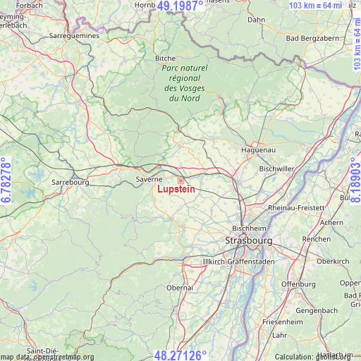
Lupstein GPS coordinates[2]
48° 44' 13.632" North, 7° 29' 9.24" East
| Map corner | latitude | longitude |
|---|---|---|
| Upper-left | 49.1987°, | 6.78278° |
| Center: | 48.73712°, | 7.4859° |
| Lower-right: | 48.27126°, | 8.18903° |
| Map W x H: | 103.1×103.1 km | = 64.1×64.1mi |
| max Lat: | 51.07786° ⇑26% North |
| Lupstein: | 48.73712° |
| min Lat: | ⇓74% South 41.3874° |
| min Long | Lupstein | max Long |
| -5.08615° | 7.4859° | 9.52242° |
| W 97.9%⇐ | ⇒2.1% E |
Elevation
Elevation of Lupstein is 192 m = 630 ft, and this is 1.7 m = 6 ft below average elevation for this country.
| Max E: |
2333 m = 7654 ft | 35.4% |
| Avg. | 193.7 m = 635 ft | |
| Lupstein | 192 m = 630 ft | |
Min E: |
-1 m = -3 ft | 64.6% |
See also: France elevation on elevation.city.
Geographical zone
Lupstein is located in North temperate zone (between Tropic of Cancer and the Arctic Circle). Distance of this North polar circle is 1982.1 km =1231.6 mi to North.| Distance of | km | miles | from Lupstein |
|---|---|---|---|
| North Pole | 4588 | 2850.9 | to North |
| Arctic Circle | 1982.1 | 1231.6 | to North |
| Tropic Cancer | 2813.1 | 1748 | to South |
| Equator | 5419.1 | 3367.3 | to South |


Nearby cities:
15 places around Lupstein: (largest is in red/bold)
• Bosselshausen
7.8 km =4.8 mi,  12°
12°
• Dettwiller
2.4 km =1.5 mi,  322°
322°
• Duntzenheim
4.6 km =2.9 mi,  127°
127°
• Hattmatt
7.6 km =4.7 mi, 321°
• Hochfelden
6.4 km =4 mi,  69°
69°
• Melsheim
3.5 km =2.2 mi,  50°
50°
• Monswiller
8.2 km =5.1 mi,  284°
284°
• Otterswiller
8 km =5 mi,  260°
260°
• Saessolsheim
3.7 km =2.3 mi,  148°
148°
• Schwenheim
5.9 km =3.7 mi,  244°
244°
• Schwindratzheim
8.5 km =5.3 mi,  75°
75°
• Steinbourg
6.5 km =4 mi,  304°
304°
• Waldolwisheim
3.6 km =2.2 mi, 262°
• Willgottheim
7.7 km =4.8 mi,  165°
165°
• Wilwisheim
1.9 km =1.2 mi, 50°
Sources, notices
• [Note1] Compared only with cities in France existing in our database
• [Src1] Map data: © OpenStreetMap contributors (CC-BY-SA)
• [Src2] Other city data from geonames.org with taken over terms of usage.
• [Src3] Geographical zone / Annual Mean Temperature by Robert A. Rohde @ Wikipedia
