Locmiquélic geodata
Locmiquélic (Brittany) is a populated place; located in France in Europe/Paris (GMT+2) time zone. With population of 4,181 people, there are 2349 cities with bigger population in this country. Compared to other cities in France, 54.6% of cities are located further ↓South; 98% of cities are located further →East and 96.7% of cities have higher elevation than Locmiquélic. Note1
Administrative division(s):
- Level 1: Brittany
- Level 2: Morbihan
- Level 3: Arrondissement de Lorient
- Level 4: Locmiquélic


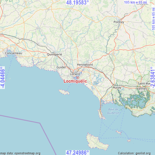
Locmiquélic GPS coordinates[2]
47° 43' 29.964" North, 3° 20' 29.508" West
| Map corner | latitude | longitude |
|---|---|---|
| Upper-left | 48.19583°, | -4.04466° |
| Center: | 47.72499°, | -3.34153° |
| Lower-right: | 47.24986°, | -2.63841° |
| Map W x H: | 105.2×105.2 km | = 65.4×65.4mi |
| max Lat: | 51.07786° ⇑45.4% North |
| Locmiquélic: | 47.72499° |
| min Lat: | ⇓54.6% South 41.3874° |
| min Long | Locmiquélic | max Long |
| -5.08615° | -3.34153° | 9.52242° |
| W 2%⇐ | ⇒98% E |
Elevation
Elevation of Locmiquélic is 12 m = 39 ft, and this is 181.7 m = 596 ft below average elevation for this country.
| Max E: |
2333 m = 7654 ft | 96.7% |
| Avg. | 193.7 m = 635 ft | |
| Locmiquélic | 12 m = 39 ft | |
Min E: |
-1 m = -3 ft | 3.3% |
See also: France elevation on elevation.city.
Geographical zone
Locmiquélic is located in North temperate zone (between Tropic of Cancer and the Arctic Circle). Distance of this North polar circle is 2094.7 km =1301.6 mi to North.| Distance of | km | miles | from Locmiquélic |
|---|---|---|---|
| North Pole | 4700.5 | 2920.8 | to North |
| Arctic Circle | 2094.7 | 1301.6 | to North |
| Tropic Cancer | 2700.6 | 1678.1 | to South |
| Equator | 5306.5 | 3297.3 | to South |


Nearby cities:
15 places around Locmiquélic: (largest is in red/bold)
• Caudan
9.3 km =5.8 mi,  359°
359°
• Gestel
11.5 km =7.1 mi,  319°
319°
• Gâvres
3.5 km =2.2 mi,  193°
193°
• Hennebont
10.3 km =6.4 mi,  29°
29°
• Kervignac
8.8 km =5.5 mi,  61°
61°
• Lanester
4 km =2.5 mi,  1°
1°
• Larmor-Plage
3.7 km =2.3 mi,  236°
236°
• Lorient
3 km =1.9 mi, 321°
• Merlevenez
8.4 km =5.2 mi,  81°
81°
• Nostang
11.9 km =7.4 mi, 77°
• Ploemeur
6.9 km =4.3 mi,  277°
277°
• Port-Louis
2.2 km =1.4 mi,  206°
206°
• Quéven
8.6 km =5.3 mi, 319°
• Riantec
2.5 km =1.6 mi,  129°
129°
• Sainte-Hélène
10.3 km =6.4 mi,  93°
93°
Sources, notices
• [Note1] Compared only with cities in France existing in our database
• [Src1] Map data: © OpenStreetMap contributors (CC-BY-SA)
• [Src2] Other city data from geonames.org with taken over terms of usage.
• [Src3] Geographical zone / Annual Mean Temperature by Robert A. Rohde @ Wikipedia
