Caudan geodata
Caudan (Brittany) is a populated place; located in France in Europe/Paris (GMT+2) time zone. With population of 7,241 people, there are 1347 cities with bigger population in this country. Compared to other cities in France, 55.9% of cities are located further ↓South; 98% of cities are located further →East and 83.1% of cities have higher elevation than Caudan. Note1
Administrative division(s):
- Level 1: Brittany
- Level 2: Morbihan
- Level 3: Arrondissement de Lorient
- Level 4: Caudan


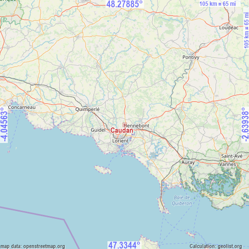
Caudan GPS coordinates[2]
47° 48' 31.572" North, 3° 20' 33" West
| Map corner | latitude | longitude |
|---|---|---|
| Upper-left | 48.27885°, | -4.04563° |
| Center: | 47.80877°, | -3.3425° |
| Lower-right: | 47.3344°, | -2.63938° |
| Map W x H: | 105×105 km | = 65.2×65.2mi |
| max Lat: | 51.07786° ⇑44.1% North |
| Caudan: | 47.80877° |
| min Lat: | ⇓55.9% South 41.3874° |
| min Long | Caudan | max Long |
| -5.08615° | -3.3425° | 9.52242° |
| W 2%⇐ | ⇒98% E |
Elevation
Elevation of Caudan is 47 m = 154 ft, and this is 146.7 m = 481 ft below average elevation for this country.
| Max E: |
2333 m = 7654 ft | 83.1% |
| Avg. | 193.7 m = 635 ft | |
| Caudan | 47 m = 154 ft | |
Min E: |
-1 m = -3 ft | 16.9% |
See also: France elevation on elevation.city.
Geographical zone
Caudan is located in North temperate zone (between Tropic of Cancer and the Arctic Circle). Distance of this North polar circle is 2085.3 km =1295.7 mi to North.| Distance of | km | miles | from Caudan |
|---|---|---|---|
| North Pole | 4691.2 | 2915 | to North |
| Arctic Circle | 2085.3 | 1295.7 | to North |
| Tropic Cancer | 2709.9 | 1683.9 | to South |
| Equator | 5315.8 | 3303.1 | to South |


Nearby cities:
15 places around Caudan: (largest is in red/bold)
• Brandérion
11.2 km =7 mi,  98°
98°
• Calan
7.6 km =4.7 mi,  11°
11°
• Cléguer
5.8 km =3.6 mi,  329°
329°
• Gestel
7.5 km =4.7 mi,  265°
265°
• Hennebont
5.2 km =3.2 mi,  94°
94°
• Kervignac
9.3 km =5.8 mi,  123°
123°
• Lanester
5.3 km =3.3 mi,  177°
177°
• Locmiquélic
9.3 km =5.8 mi, 179°
• Lorient
7.2 km =4.5 mi,  194°
194°
• Ploemeur
10.8 km =6.7 mi,  218°
218°
• Pont-Scorff
5.3 km =3.3 mi,  301°
301°
• Port-Louis
11.3 km =7 mi, 184°
• Quéven
6.2 km =3.9 mi,  242°
242°
• Riantec
11.1 km =6.9 mi,  169°
169°
• Rédené
10.3 km =6.4 mi, 296°
Sources, notices
• [Note1] Compared only with cities in France existing in our database
• [Src1] Map data: © OpenStreetMap contributors (CC-BY-SA)
• [Src2] Other city data from geonames.org with taken over terms of usage.
• [Src3] Geographical zone / Annual Mean Temperature by Robert A. Rohde @ Wikipedia
