Liverdun geodata
Liverdun (Grand Est) is a populated place; located in France in Europe/Paris (GMT+2) time zone. With population of 6,500 people, there are 1515 cities with bigger population in this country. Compared to other cities in France, 74.3% of cities are located further ↓South; 87.8% of cities are located further ←West and 67.2% of cities have lower elevation than Liverdun. Note1
Administrative division(s):
- Level 1: Grand Est
- Level 2: Meurthe-et-Moselle
- Level 3: Arrondissement de Toul
- Level 4: Liverdun


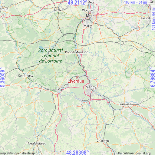
Liverdun GPS coordinates[2]
48° 44' 59.028" North, 6° 3' 49.392" East
| Map corner | latitude | longitude |
|---|---|---|
| Upper-left | 49.2112°, | 5.36059° |
| Center: | 48.74973°, | 6.06372° |
| Lower-right: | 48.28398°, | 6.76684° |
| Map W x H: | 103.1×103.1 km | = 64.1×64.1mi |
| max Lat: | 51.07786° ⇑25.7% North |
| Liverdun: | 48.74973° |
| min Lat: | ⇓74.3% South 41.3874° |
| min Long | Liverdun | max Long |
| -5.08615° | 6.06372° | 9.52242° |
| W 87.8%⇐ | ⇒12.2% E |
Elevation
Elevation of Liverdun is 205 m = 673 ft, and this is 11.3 m = 37 ft above average elevation for this country.
| Max E: |
2333 m = 7654 ft | 32.8% |
| Liverdun | 205 m 673 ft | |
| Avg. | 193.7 m = 635 ft | |
Min E: |
-1 m = -3 ft | 67.2% |
See also: France elevation on elevation.city.
Geographical zone
Liverdun is located in North temperate zone (between Tropic of Cancer and the Arctic Circle). Distance of this North polar circle is 1980.7 km =1230.7 mi to North.| Distance of | km | miles | from Liverdun |
|---|---|---|---|
| North Pole | 4586.6 | 2850 | to North |
| Arctic Circle | 1980.7 | 1230.7 | to North |
| Tropic Cancer | 2814.5 | 1748.8 | to South |
| Equator | 5420.5 | 3368.1 | to South |


Nearby cities:
15 places around Liverdun: (largest is in red/bold)
• Aingeray
4.7 km =2.9 mi,  254°
254°
• Belleville
8.1 km =5 mi,  20°
20°
• Bouxières-aux-Dames
7.3 km =4.5 mi,  85°
85°
• Champigneulles
7.4 km =4.6 mi,  103°
103°
• Custines
7.5 km =4.7 mi,  52°
52°
• Frouard
5 km =3.1 mi,  76°
76°
• Gondreville
9.6 km =6 mi,  229°
229°
• Laxou
9.7 km =6 mi,  139°
139°
• Malleloy
8.8 km =5.5 mi,  55°
55°
• Marbache
6.3 km =3.9 mi,  29°
29°
• Maxéville
8.6 km =5.3 mi,  118°
118°
• Pompey
5.1 km =3.2 mi,  65°
65°
• Saizerais
5 km =3.1 mi,  343°
343°
• Velaine-en-Haye
6.1 km =3.8 mi,  205°
205°
• Villey-Saint-Étienne
6.5 km =4 mi, 252°
Sources, notices
• [Note1] Compared only with cities in France existing in our database
• [Src1] Map data: © OpenStreetMap contributors (CC-BY-SA)
• [Src2] Other city data from geonames.org with taken over terms of usage.
• [Src3] Geographical zone / Annual Mean Temperature by Robert A. Rohde @ Wikipedia
