Les Hautes-Rivières geodata
Les Hautes-Rivières (Grand Est) is a populated place; located in France in Europe/Paris (GMT+2) time zone. With population of 1,945 people, there are 4921 cities with bigger population in this country. Compared to other cities in France, 92.9% of cities are located further ↓South; 75.7% of cities are located further ←West and 58% of cities have lower elevation than Les Hautes-Rivières. Note1
Administrative division(s):
- Level 1: Grand Est
- Level 2: Ardennes
- Level 3: Arrondissement de Charleville-Mézières
- Level 4: Les Hautes-Rivières


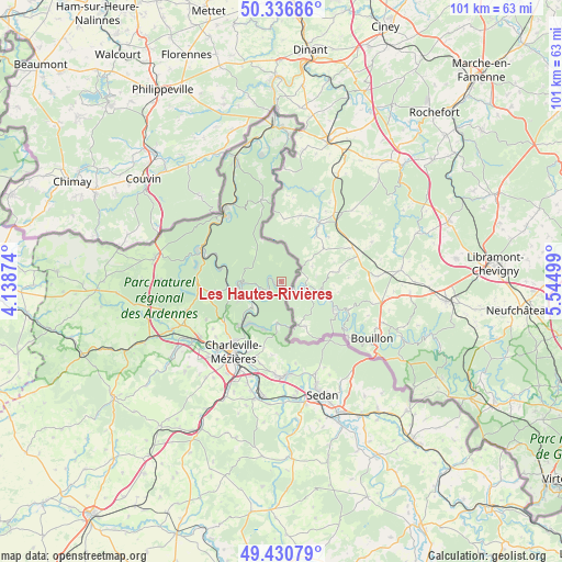
Les Hautes-Rivières GPS coordinates[2]
49° 53' 9.42" North, 4° 50' 30.696" East
| Map corner | latitude | longitude |
|---|---|---|
| Upper-left | 50.33686°, | 4.13874° |
| Center: | 49.88595°, | 4.84186° |
| Lower-right: | 49.43079°, | 5.54499° |
| Map W x H: | 100.7×100.7 km | = 62.6×62.6mi |
| max Lat: | 51.07786° ⇑7.1% North |
| Les Hautes-Rivières: | 49.88595° |
| min Lat: | ⇓92.9% South 41.3874° |
| min Long | Les Hautes-Rivi | max Long |
| -5.08615° | 4.84186° | 9.52242° |
| W 75.7%⇐ | ⇒24.3% E |
Elevation
Elevation of Les Hautes-Rivières is 161 m = 528 ft, and this is 32.7 m = 107 ft below average elevation for this country.
| Max E: |
2333 m = 7654 ft | 42% |
| Avg. | 193.7 m = 635 ft | |
| Les Hautes-Rivières | 161 m = 528 ft | |
Min E: |
-1 m = -3 ft | 58% |
See also: France elevation on elevation.city.
Geographical zone
Les Hautes-Rivières is located in North temperate zone (between Tropic of Cancer and the Arctic Circle). Distance of this North polar circle is 1854.4 km =1152.3 mi to North.| Distance of | km | miles | from Les Hautes-Rivières |
|---|---|---|---|
| North Pole | 4460.3 | 2771.5 | to North |
| Arctic Circle | 1854.4 | 1152.3 | to North |
| Tropic Cancer | 2940.9 | 1827.4 | to South |
| Equator | 5546.8 | 3446.6 | to South |


Nearby cities:
15 places around Les Hautes-Rivières: (largest is in red/bold)
• Aiglemont
13 km =8.1 mi,  205°
205°
• Charleville-Mézières
15.5 km =9.6 mi, 212°
• Deville
9.8 km =6.1 mi,  265°
265°
• Fumay
15.1 km =9.4 mi,  320°
320°
• Gespunsart
7.2 km =4.5 mi,  187°
187°
• Hargnies
15.3 km =9.5 mi,  346°
346°
• Joigny-sur-Meuse
7.9 km =4.9 mi,  226°
226°
• La Grandville
12.2 km =7.6 mi,  195°
195°
• Laifour
11 km =6.8 mi,  285°
285°
• Montcy-Notre-Dame
14.2 km =8.8 mi, 210°
• Monthermé
8 km =5 mi, 268°
• Neufmanil
8.9 km =5.5 mi, 201°
• Nouzonville
10.5 km =6.5 mi,  220°
220°
• Saint-Laurent
14.4 km =8.9 mi, 200°
• Thilay
2.8 km =1.7 mi,  240°
240°
Sources, notices
• [Note1] Compared only with cities in France existing in our database
• [Src1] Map data: © OpenStreetMap contributors (CC-BY-SA)
• [Src2] Other city data from geonames.org with taken over terms of usage.
• [Src3] Geographical zone / Annual Mean Temperature by Robert A. Rohde @ Wikipedia
