Le Cloître-Pleyben geodata
Le Cloître-Pleyben (Brittany) is a populated place; located in France in Europe/Paris (GMT+2) time zone. With population of 562 people, there are 13969 cities with bigger population in this country. Compared to other cities in France, 63.8% of cities are located further ↓South; 98.9% of cities are located further →East and 53.9% of cities have lower elevation than Le Cloître-Pleyben. Note1
Administrative division(s):
- Level 1: Brittany
- Level 2: Département du Finistère
- Level 3: Arrondissement de Châteaulin
- Level 4: Le Cloître-Pleyben


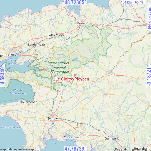
Le Cloître-Pleyben GPS coordinates[2]
48° 15' 27.576" North, 3° 53' 25.188" West
| Map corner | latitude | longitude |
|---|---|---|
| Upper-left | 48.72365°, | -4.59346° |
| Center: | 48.25766°, | -3.89033° |
| Lower-right: | 47.78739°, | -3.18721° |
| Map W x H: | 104.1×104.1 km | = 64.7×64.7mi |
| max Lat: | 51.07786° ⇑36.2% North |
| Le Cloître-Pleyben: | 48.25766° |
| min Lat: | ⇓63.8% South 41.3874° |
| min Long | Le Cloître-Ple | max Long |
| -5.08615° | -3.89033° | 9.52242° |
| W 1.1%⇐ | ⇒98.9% E |
Elevation
Elevation of Le Cloître-Pleyben is 146 m = 479 ft, and this is 47.7 m = 156 ft below average elevation for this country.
| Max E: |
2333 m = 7654 ft | 46.1% |
| Avg. | 193.7 m = 635 ft | |
| Le Cloître-Pleyben | 146 m = 479 ft | |
Min E: |
-1 m = -3 ft | 53.9% |
See also: France elevation on elevation.city.
Geographical zone
Le Cloître-Pleyben is located in North temperate zone (between Tropic of Cancer and the Arctic Circle). Distance of this North polar circle is 2035.4 km =1264.7 mi to North.| Distance of | km | miles | from Le Cloître-Pleyben |
|---|---|---|---|
| North Pole | 4641.3 | 2884 | to North |
| Arctic Circle | 2035.4 | 1264.7 | to North |
| Tropic Cancer | 2759.8 | 1714.9 | to South |
| Equator | 5365.7 | 3334.1 | to South |


Nearby cities:
15 places around Le Cloître-Pleyben: (largest is in red/bold)
• Brasparts
6.9 km =4.3 mi,  315°
315°
• Châteauneuf-du-Faou
9.5 km =5.9 mi,  145°
145°
• Collorec
9.1 km =5.7 mi,  70°
70°
• Gouézec
11.6 km =7.2 mi,  211°
211°
• Landeleau
12.4 km =7.7 mi,  105°
105°
• Laz
13.9 km =8.6 mi,  162°
162°
• Lennon
7.2 km =4.5 mi,  183°
183°
• Lopérec
11.8 km =7.3 mi,  280°
280°
• Pleyben
6.3 km =3.9 mi,  244°
244°
• Plonévez-du-Faou
4.3 km =2.7 mi,  101°
101°
• Plouyé
13.3 km =8.3 mi,  60°
60°
• Saint-Goazec
12.9 km =8 mi,  141°
141°
• Saint-Ségal
13.3 km =8.3 mi,  258°
258°
• Saint-Thois
10.1 km =6.3 mi, 177°
• Spézet
14.4 km =8.9 mi,  116°
116°
Sources, notices
• [Note1] Compared only with cities in France existing in our database
• [Src1] Map data: © OpenStreetMap contributors (CC-BY-SA)
• [Src2] Other city data from geonames.org with taken over terms of usage.
• [Src3] Geographical zone / Annual Mean Temperature by Robert A. Rohde @ Wikipedia
