Brasparts geodata
Brasparts (Brittany) is a populated place; located in France in Europe/Paris (GMT+2) time zone. With population of 1,071 people, there are 8327 cities with bigger population in this country. Compared to other cities in France, 64.6% of cities are located further ↓South; 98.9% of cities are located further →East and 50.9% of cities have higher elevation than Brasparts. Note1
Administrative division(s):
- Level 1: Brittany
- Level 2: Département du Finistère
- Level 3: Arrondissement de Châteaulin
- Level 4: Brasparts


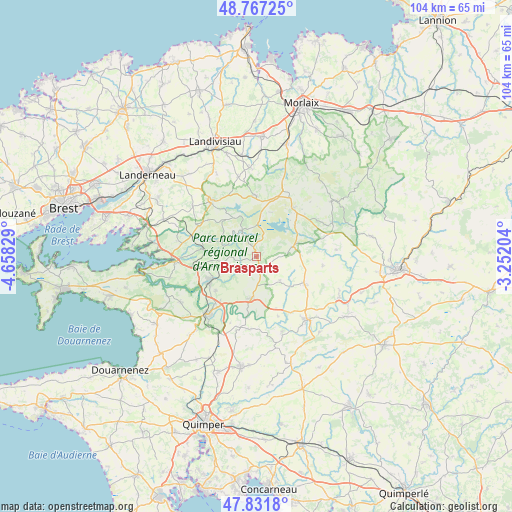
Brasparts GPS coordinates[2]
48° 18' 6.012" North, 3° 57' 18.576" West
| Map corner | latitude | longitude |
|---|---|---|
| Upper-left | 48.76725°, | -4.65829° |
| Center: | 48.30167°, | -3.95516° |
| Lower-right: | 47.8318°, | -3.25204° |
| Map W x H: | 104×104 km | = 64.6×64.6mi |
| max Lat: | 51.07786° ⇑35.4% North |
| Brasparts: | 48.30167° |
| min Lat: | ⇓64.6% South 41.3874° |
| min Long | Brasparts | max Long |
| -5.08615° | -3.95516° | 9.52242° |
| W 1.1%⇐ | ⇒98.9% E |
Elevation
Elevation of Brasparts is 129 m = 423 ft, and this is 64.7 m = 212 ft below average elevation for this country.
| Max E: |
2333 m = 7654 ft | 50.9% |
| Avg. | 193.7 m = 635 ft | |
| Brasparts | 129 m = 423 ft | |
Min E: |
-1 m = -3 ft | 49.1% |
See also: France elevation on elevation.city.
Geographical zone
Brasparts is located in North temperate zone (between Tropic of Cancer and the Arctic Circle). Distance of this North polar circle is 2030.5 km =1261.7 mi to North.| Distance of | km | miles | from Brasparts |
|---|---|---|---|
| North Pole | 4636.4 | 2880.9 | to North |
| Arctic Circle | 2030.5 | 1261.7 | to North |
| Tropic Cancer | 2764.7 | 1717.9 | to South |
| Equator | 5370.6 | 3337.1 | to South |


Nearby cities:
15 places around Brasparts: (largest is in red/bold)
• Châteaulin
15.4 km =9.6 mi,  220°
220°
• Châteauneuf-du-Faou
16.3 km =10.1 mi,  141°
141°
• Collorec
13.5 km =8.4 mi,  97°
97°
• Commana
12.4 km =7.7 mi,  359°
359°
• Gouézec
14.8 km =9.2 mi,  185°
185°
• Hanvec
15.4 km =9.6 mi,  280°
280°
• La Feuillée
12.4 km =7.7 mi,  36°
36°
• Le Cloître-Pleyben
6.9 km =4.3 mi, 135°
• Lennon
12.9 km =8 mi,  160°
160°
• Lopérec
7.4 km =4.6 mi,  248°
248°
• Pleyben
7.6 km =4.7 mi, 186°
• Plonévez-du-Faou
10.7 km =6.6 mi,  122°
122°
• Saint-Ségal
11.2 km =7 mi,  227°
227°
• Saint-Thois
15.9 km =9.9 mi, 160°
• Sizun
14.5 km =9 mi,  319°
319°
Sources, notices
• [Note1] Compared only with cities in France existing in our database
• [Src1] Map data: © OpenStreetMap contributors (CC-BY-SA)
• [Src2] Other city data from geonames.org with taken over terms of usage.
• [Src3] Geographical zone / Annual Mean Temperature by Robert A. Rohde @ Wikipedia
