Laugnac geodata
Laugnac (Nouvelle-Aquitaine) is a populated place; located in France in Europe/Paris (GMT+2) time zone. With population of 576 people, there are 13727 cities with bigger population in this country. Compared to other cities in France, 84.8% of cities are located further ↑North; 72.3% of cities are located further →East and 63.6% of cities have lower elevation than Laugnac. Note1
Administrative division(s):
- Level 1: Nouvelle-Aquitaine
- Level 2: Département du Lot-et-Garonne
- Level 3: Agen
- Level 4: Laugnac


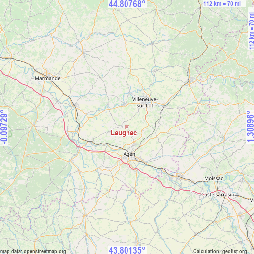
Laugnac GPS coordinates[2]
44° 18' 24.012" North, 0° 36' 20.988" East
| Map corner | latitude | longitude |
|---|---|---|
| Upper-left | 44.80768°, | -0.09729° |
| Center: | 44.30667°, | 0.60583° |
| Lower-right: | 43.80135°, | 1.30896° |
| Map W x H: | 111.9×111.9 km | = 69.5×69.5mi |
| max Lat: | 51.07786° ⇑84.8% North |
| Laugnac: | 44.30667° |
| min Lat: | ⇓15.2% South 41.3874° |
| min Long | Laugnac | max Long |
| -5.08615° | 0.60583° | 9.52242° |
| W 27.7%⇐ | ⇒72.3% E |
Elevation
Elevation of Laugnac is 187 m = 614 ft, and this is 6.7 m = 22 ft below average elevation for this country.
| Max E: |
2333 m = 7654 ft | 36.4% |
| Avg. | 193.7 m = 635 ft | |
| Laugnac | 187 m = 614 ft | |
Min E: |
-1 m = -3 ft | 63.6% |
See also: France elevation on elevation.city.
Geographical zone
Laugnac is located in North temperate zone (between Tropic of Cancer and the Arctic Circle). Distance of this Northern Tropic circle is 2320.5 km =1441.9 mi to South.| Distance of | km | miles | from Laugnac |
|---|---|---|---|
| North Pole | 5080.6 | 3156.9 | to North |
| Arctic Circle | 2474.7 | 1537.7 | to North |
| Tropic Cancer | 2320.5 | 1441.9 | to South |
| Equator | 4926.4 | 3061.1 | to South |


Nearby cities:
15 places around Laugnac: (largest is in red/bold)
• Agen
12 km =7.5 mi,  172°
172°
• Allez-et-Cazeneuve
10.4 km =6.5 mi,  4°
4°
• Brax
12.3 km =7.6 mi,  200°
200°
• Colayrac-Saint-Cirq
10.5 km =6.5 mi, 204°
• Dolmayrac
6.3 km =3.9 mi,  347°
347°
• Foulayronnes
8 km =5 mi,  157°
157°
• La Croix-Blanche
7.1 km =4.4 mi,  101°
101°
• Le Passage
11.7 km =7.3 mi,  181°
181°
• Le Temple-sur-Lot
10.3 km =6.4 mi,  321°
321°
• Montpezat
8 km =5 mi,  305°
305°
• Pont-du-Casse
10.5 km =6.5 mi,  146°
146°
• Prayssas
11.3 km =7 mi,  250°
250°
• Pujols
11.7 km =7.3 mi,  33°
33°
• Saint-Antoine-de-Ficalba
9.4 km =5.8 mi,  72°
72°
• Sainte-Livrade-sur-Lot
10.4 km =6.5 mi, 353°
Sources, notices
• [Note1] Compared only with cities in France existing in our database
• [Src1] Map data: © OpenStreetMap contributors (CC-BY-SA)
• [Src2] Other city data from geonames.org with taken over terms of usage.
• [Src3] Geographical zone / Annual Mean Temperature by Robert A. Rohde @ Wikipedia
