Lantignié geodata
Lantignié (Auvergne-Rhône-Alpes) is a populated place; located in France in Europe/Paris (GMT+2) time zone. With population of 667 people, there are 12267 cities with bigger population in this country. Compared to other cities in France, 64.3% of cities are located further ↑North; 73% of cities are located further ←West and 84.6% of cities have lower elevation than Lantignié. Note1
Administrative division(s):
- Level 1: Auvergne-Rhône-Alpes
- Level 2: Département du Rhône
- Level 3: Arrondissement de Villefranche-sur-Saône
- Level 4: Lantignié


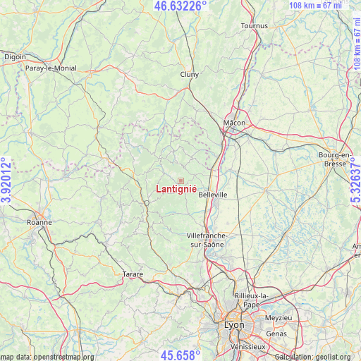
Lantignié GPS coordinates[2]
46° 8' 50.244" North, 4° 37' 23.664" East
| Map corner | latitude | longitude |
|---|---|---|
| Upper-left | 46.63226°, | 3.92012° |
| Center: | 46.14729°, | 4.62324° |
| Lower-right: | 45.658°, | 5.32637° |
| Map W x H: | 108.3×108.3 km | = 67.3×67.3mi |
| max Lat: | 51.07786° ⇑64.3% North |
| Lantignié: | 46.14729° |
| min Lat: | ⇓35.7% South 41.3874° |
| min Long | Lantignié | max Long |
| -5.08615° | 4.62324° | 9.52242° |
| W 73%⇐ | ⇒27% E |
Elevation
Elevation of Lantignié is 341 m = 1119 ft, and this is 147.3 m = 483 ft above average elevation for this country.
| Max E: |
2333 m = 7654 ft | 15.4% |
| Lantignié | 341 m 1119 ft | |
| Avg. | 193.7 m = 635 ft | |
Min E: |
-1 m = -3 ft | 84.6% |
See also: France elevation on elevation.city.
Geographical zone
Lantignié is located in North temperate zone (between Tropic of Cancer and the Arctic Circle). Distance of this North polar circle is 2270.1 km =1410.6 mi to North.| Distance of | km | miles | from Lantignié |
|---|---|---|---|
| North Pole | 4876 | 3029.8 | to North |
| Arctic Circle | 2270.1 | 1410.6 | to North |
| Tropic Cancer | 2525.2 | 1569.1 | to South |
| Equator | 5131.1 | 3188.3 | to South |


Nearby cities:
15 places around Lantignié: (largest is in red/bold)
• Beaujeu
2.8 km =1.7 mi,  286°
286°
• Cercié
4.8 km =3 mi,  130°
130°
• Charentay
7.8 km =4.8 mi,  146°
146°
• Corcelles-en-Beaujolais
7.8 km =4.8 mi,  84°
84°
• Durette
2.9 km =1.8 mi,  117°
117°
• Fleurie
7.6 km =4.7 mi,  48°
48°
• Lancié
7.5 km =4.7 mi,  69°
69°
• Le Perréon
9.5 km =5.9 mi,  190°
190°
• Les Ardillats
7.3 km =4.5 mi,  299°
299°
• Odenas
6.8 km =4.2 mi,  164°
164°
• Quincié-en-Beaujolais
3.2 km =2 mi, 189°
• Saint-Lager
5.5 km =3.4 mi,  136°
136°
• Saint-Étienne-des-Oullières
9.1 km =5.7 mi,  167°
167°
• Saint-Étienne-la-Varenne
7.9 km =4.9 mi,  175°
175°
• Villié-Morgon
4.7 km =2.9 mi, 69°
Sources, notices
• [Note1] Compared only with cities in France existing in our database
• [Src1] Map data: © OpenStreetMap contributors (CC-BY-SA)
• [Src2] Other city data from geonames.org with taken over terms of usage.
• [Src3] Geographical zone / Annual Mean Temperature by Robert A. Rohde @ Wikipedia
