Lannion geodata
Lannion (Brittany) is a seat of a third-order administrative division; located in France in Europe/Paris (GMT+2) time zone. With population of 21,473 people, there are 420 cities with bigger population in this country. Compared to other cities in France, 73.9% of cities are located further ↓South; 98.3% of cities are located further →East and 85.9% of cities have higher elevation than Lannion. Note1
Administrative division(s):
- Level 1: Brittany
- Level 2: Département des Côtes-d’Armor
- Level 3: Arrondissement de Lannion
- Level 4: Lannion


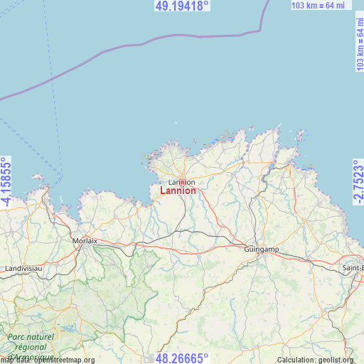
Lannion GPS coordinates[2]
48° 43' 57.18" North, 3° 27' 19.512" West
| Map corner | latitude | longitude |
|---|---|---|
| Upper-left | 49.19418°, | -4.15855° |
| Center: | 48.73255°, | -3.45542° |
| Lower-right: | 48.26665°, | -2.7523° |
| Map W x H: | 103.1×103.1 km | = 64.1×64.1mi |
| max Lat: | 51.07786° ⇑26.1% North |
| Lannion: | 48.73255° |
| min Lat: | ⇓73.9% South 41.3874° |
| min Long | Lannion | max Long |
| -5.08615° | -3.45542° | 9.52242° |
| W 1.7%⇐ | ⇒98.3% E |
Elevation
Elevation of Lannion is 40 m = 131 ft, and this is 153.7 m = 504 ft below average elevation for this country.
| Max E: |
2333 m = 7654 ft | 85.9% |
| Avg. | 193.7 m = 635 ft | |
| Lannion | 40 m = 131 ft | |
Min E: |
-1 m = -3 ft | 14.1% |
See also: France elevation on elevation.city.
Geographical zone
Lannion is located in North temperate zone (between Tropic of Cancer and the Arctic Circle). Distance of this North polar circle is 1982.6 km =1231.9 mi to North.| Distance of | km | miles | from Lannion |
|---|---|---|---|
| North Pole | 4588.5 | 2851.2 | to North |
| Arctic Circle | 1982.6 | 1231.9 | to North |
| Tropic Cancer | 2812.6 | 1747.7 | to South |
| Equator | 5418.6 | 3367 | to South |


Nearby cities:
15 places around Lannion: (largest is in red/bold)
• Caouënnec-Lanvézéac
7.4 km =4.6 mi,  119°
119°
• Cavan
10.4 km =6.5 mi,  129°
129°
• Kermaria-Sulard
7.7 km =4.8 mi,  54°
54°
• Locquémeau
7.9 km =4.9 mi,  263°
263°
• Louannec
7.6 km =4.7 mi,  24°
24°
• Perros-Guirec
9.2 km =5.7 mi,  7°
7°
• Pleumeur-Bodou
5.9 km =3.7 mi,  310°
310°
• Ploubezre
3.6 km =2.2 mi,  173°
173°
• Ploumilliau
7.1 km =4.4 mi,  219°
219°
• Rospez
5.3 km =3.3 mi,  93°
93°
• Saint-Quay-Perros
5.7 km =3.5 mi,  4°
4°
• Tonquédec
8.3 km =5.2 mi,  148°
148°
• Trébeurden
9 km =5.6 mi,  294°
294°
• Trédrez-Locquémeau
8.9 km =5.5 mi,  246°
246°
• Trégastel
9.9 km =6.2 mi,  340°
340°
Sources, notices
• [Note1] Compared only with cities in France existing in our database
• [Src1] Map data: © OpenStreetMap contributors (CC-BY-SA)
• [Src2] Other city data from geonames.org with taken over terms of usage.
• [Src3] Geographical zone / Annual Mean Temperature by Robert A. Rohde @ Wikipedia
