Landaul geodata
Landaul (Brittany) is a populated place; located in France in Europe/Paris (GMT+2) time zone. With population of 1,434 people, there are 6461 cities with bigger population in this country. Compared to other cities in France, 55% of cities are located further ↓South; 97.5% of cities are located further →East and 86.7% of cities have higher elevation than Landaul. Note1
Administrative division(s):
- Level 1: Brittany
- Level 2: Morbihan
- Level 3: Arrondissement de Lorient
- Level 4: Landaul


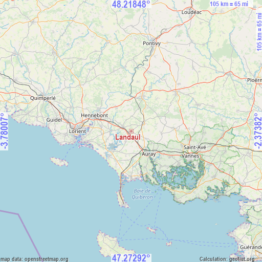
Landaul GPS coordinates[2]
47° 44' 52.26" North, 3° 4' 36.984" West
| Map corner | latitude | longitude |
|---|---|---|
| Upper-left | 48.21848°, | -3.78007° |
| Center: | 47.74785°, | -3.07694° |
| Lower-right: | 47.27292°, | -2.37382° |
| Map W x H: | 105.1×105.1 km | = 65.3×65.3mi |
| max Lat: | 51.07786° ⇑45% North |
| Landaul: | 47.74785° |
| min Lat: | ⇓55% South 41.3874° |
| min Long | Landaul | max Long |
| -5.08615° | -3.07694° | 9.52242° |
| W 2.5%⇐ | ⇒97.5% E |
Elevation
Elevation of Landaul is 38 m = 125 ft, and this is 155.7 m = 511 ft below average elevation for this country.
| Max E: |
2333 m = 7654 ft | 86.7% |
| Avg. | 193.7 m = 635 ft | |
| Landaul | 38 m = 125 ft | |
Min E: |
-1 m = -3 ft | 13.3% |
See also: France elevation on elevation.city.
Geographical zone
Landaul is located in North temperate zone (between Tropic of Cancer and the Arctic Circle). Distance of this North polar circle is 2092.1 km =1300 mi to North.| Distance of | km | miles | from Landaul |
|---|---|---|---|
| North Pole | 4698 | 2919.2 | to North |
| Arctic Circle | 2092.1 | 1300 | to North |
| Tropic Cancer | 2703.1 | 1679.6 | to South |
| Equator | 5309.1 | 3298.9 | to South |


Nearby cities:
15 places around Landaul: (largest is in red/bold)
• Auray
10.7 km =6.6 mi,  143°
143°
• Belz
10.6 km =6.6 mi,  220°
220°
• Brandivy
10.3 km =6.4 mi,  74°
74°
• Brandérion
10.2 km =6.3 mi,  300°
300°
• Brech
6.6 km =4.1 mi,  116°
116°
• Landévant
3.9 km =2.4 mi, 299°
• Languidic
11.2 km =7 mi,  327°
327°
• Locoal-Mendon
5.3 km =3.3 mi,  206°
206°
• Merlevenez
11.6 km =7.2 mi,  263°
263°
• Nostang
8.2 km =5.1 mi,  270°
270°
• Ploemel
10.7 km =6.6 mi,  177°
177°
• Pluneret
12 km =7.5 mi,  132°
132°
• Pluvigner
5.9 km =3.7 mi,  57°
57°
• Sainte-Anne-d'Auray
10.9 km =6.8 mi, 119°
• Sainte-Hélène
10 km =6.2 mi,  251°
251°
Sources, notices
• [Note1] Compared only with cities in France existing in our database
• [Src1] Map data: © OpenStreetMap contributors (CC-BY-SA)
• [Src2] Other city data from geonames.org with taken over terms of usage.
• [Src3] Geographical zone / Annual Mean Temperature by Robert A. Rohde @ Wikipedia
