Brandérion geodata
Brandérion (Brittany) is a populated place; located in France in Europe/Paris (GMT+1) time zone. With population of 1,030 people, there are 8614 cities with bigger population in this country. Compared to other cities in France, 55.6% of cities are located further ↓South; 97.7% of cities are located further →East and 84.1% of cities have higher elevation than Brandérion. Note1
Administrative division(s):
- Level 1: Brittany
- Level 2: Morbihan
- Level 3: Arrondissement de Lorient
- Level 4: Brandérion


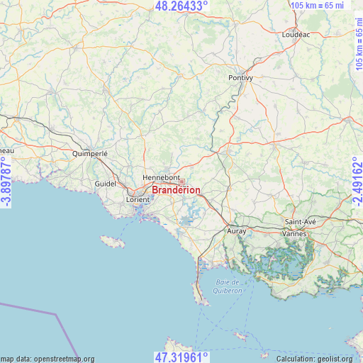
Brandérion GPS coordinates[2]
47° 47' 38.832" North, 3° 11' 41.064" West
| Map corner | latitude | longitude |
|---|---|---|
| Upper-left | 48.26433°, | -3.89787° |
| Center: | 47.79412°, | -3.19474° |
| Lower-right: | 47.31961°, | -2.49162° |
| Map W x H: | 105×105 km | = 65.2×65.2mi |
| max Lat: | 51.07786° ⇑44.4% North |
| Brandérion: | 47.79412° |
| min Lat: | ⇓55.6% South 41.3874° |
| min Long | Brandérion | max Long |
| -5.08615° | -3.19474° | 9.52242° |
| W 2.3%⇐ | ⇒97.7% E |
Elevation
Elevation of Brandérion is 44 m = 144 ft, and this is 149.7 m = 491 ft below average elevation for this country.
| Max E: |
2333 m = 7654 ft | 84.1% |
| Avg. | 193.7 m = 635 ft | |
| Brandérion | 44 m = 144 ft | |
Min E: |
-1 m = -3 ft | 15.9% |
See also: France elevation on elevation.city.
Geographical zone
Brandérion is located in North temperate zone (between Tropic of Cancer and the Arctic Circle). Distance of this North polar circle is 2087 km =1296.8 mi to North.| Distance of | km | miles | from Brandérion |
|---|---|---|---|
| North Pole | 4692.9 | 2916 | to North |
| Arctic Circle | 2087 | 1296.8 | to North |
| Tropic Cancer | 2708.3 | 1682.9 | to South |
| Equator | 5314.2 | 3302.1 | to South |


Nearby cities:
15 places around Brandérion: (largest is in red/bold)
• Calan
13.2 km =8.2 mi,  313°
313°
• Caudan
11.2 km =7 mi,  278°
278°
• Hennebont
6 km =3.7 mi, 281°
• Kervignac
4.7 km =2.9 mi,  222°
222°
• Landaul
10.2 km =6.3 mi,  120°
120°
• Landévant
6.3 km =3.9 mi, 120°
• Lanester
11.4 km =7.1 mi,  251°
251°
• Languidic
5.1 km =3.2 mi,  32°
32°
• Lanvaudan
12.7 km =7.9 mi,  336°
336°
• Locoal-Mendon
11.8 km =7.3 mi,  146°
146°
• Merlevenez
7 km =4.3 mi,  202°
202°
• Nostang
5.1 km =3.2 mi,  172°
172°
• Quistinic
13 km =8.1 mi,  20°
20°
• Riantec
13 km =8.1 mi, 224°
• Sainte-Hélène
8.3 km =5.2 mi,  184°
184°
Sources, notices
• [Note1] Compared only with cities in France existing in our database
• [Src1] Map data: © OpenStreetMap contributors (CC-BY-SA)
• [Src2] Other city data from geonames.org with taken over terms of usage.
• [Src3] Geographical zone / Annual Mean Temperature by Robert A. Rohde @ Wikipedia
