Laigné-en-Belin geodata
Laigné-en-Belin (Pays de la Loire) is a populated place; located in France in Europe/Paris (GMT+2) time zone. With population of 2,043 people, there are 4700 cities with bigger population in this country. Compared to other cities in France, 57.1% of cities are located further ↓South; 76% of cities are located further →East and 75.8% of cities have higher elevation than Laigné-en-Belin. Note1
Administrative division(s):
- Level 1: Pays de la Loire
- Level 2: Sarthe
- Level 3: Arrondissement du Mans
- Level 4: Laigné-en-Belin


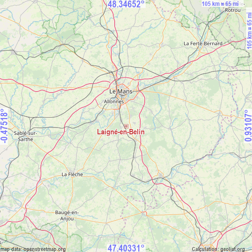
Laigné-en-Belin GPS coordinates[2]
47° 52' 37.416" North, 0° 13' 40.62" East
| Map corner | latitude | longitude |
|---|---|---|
| Upper-left | 48.34652°, | -0.47518° |
| Center: | 47.87706°, | 0.22795° |
| Lower-right: | 47.40331°, | 0.93107° |
| Map W x H: | 104.9×104.9 km | = 65.2×65.2mi |
| max Lat: | 51.07786° ⇑42.9% North |
| Laigné-en-Belin: | 47.87706° |
| min Lat: | ⇓57.1% South 41.3874° |
| min Long | Laigné-en-Beli | max Long |
| -5.08615° | 0.22795° | 9.52242° |
| W 24%⇐ | ⇒76% E |
Elevation
Elevation of Laigné-en-Belin is 65 m = 213 ft, and this is 128.7 m = 422 ft below average elevation for this country.
| Max E: |
2333 m = 7654 ft | 75.8% |
| Avg. | 193.7 m = 635 ft | |
| Laigné-en-Belin | 65 m = 213 ft | |
Min E: |
-1 m = -3 ft | 24.2% |
See also: France elevation on elevation.city.
Geographical zone
Laigné-en-Belin is located in North temperate zone (between Tropic of Cancer and the Arctic Circle). Distance of this North polar circle is 2077.7 km =1291 mi to North.| Distance of | km | miles | from Laigné-en-Belin |
|---|---|---|---|
| North Pole | 4683.6 | 2910.3 | to North |
| Arctic Circle | 2077.7 | 1291 | to North |
| Tropic Cancer | 2717.5 | 1688.6 | to South |
| Equator | 5323.4 | 3307.8 | to South |


Nearby cities:
15 places around Laigné-en-Belin: (largest is in red/bold)
• Arnage
6.2 km =3.9 mi,  331°
331°
• Brette-les-Pins
8.9 km =5.5 mi,  65°
65°
• Fillé
8.1 km =5 mi,  288°
288°
• Guécélard
7.4 km =4.6 mi,  270°
270°
• Moncé-en-Belin
2.9 km =1.8 mi,  310°
310°
• Mulsanne
4.2 km =2.6 mi,  22°
22°
• Ruaudin
8.1 km =5 mi, 21°
• Saint-Biez-en-Belin
6.3 km =3.9 mi,  172°
172°
• Saint-Gervais-en-Belin
0.8 km =0.5 mi, 271°
• Saint-Mars-d’Outillé
7.8 km =4.8 mi,  95°
95°
• Saint-Ouen-en-Belin
5.1 km =3.2 mi,  195°
195°
• Spay
7.7 km =4.8 mi, 312°
• Teloché
3.4 km =2.1 mi, 68°
• Yvré-le-Pôlin
8.1 km =5 mi,  221°
221°
• Écommoy
6.7 km =4.2 mi,  148°
148°
Sources, notices
• [Note1] Compared only with cities in France existing in our database
• [Src1] Map data: © OpenStreetMap contributors (CC-BY-SA)
• [Src2] Other city data from geonames.org with taken over terms of usage.
• [Src3] Geographical zone / Annual Mean Temperature by Robert A. Rohde @ Wikipedia
