La Ferrière-en-Parthenay geodata
La Ferrière-en-Parthenay (Nouvelle-Aquitaine) is a populated place; located in France in Europe/Paris (GMT+2) time zone. With population of 776 people, there are 10868 cities with bigger population in this country. Compared to other cities in France, 58.7% of cities are located further ↑North; 78.7% of cities are located further →East and 58.7% of cities have lower elevation than La Ferrière-en-Parthenay. Note1
Administrative division(s):
- Level 1: Nouvelle-Aquitaine
- Level 2: Département des Deux-Sèvres
- Level 3: Arrondissement de Parthenay
- Level 4: La Ferrière-en-Parthenay
Current local time in La Ferrière-en-Parthenay:
01:13 PM, SaturdayDifference from your time zone: hours


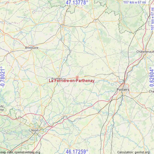
La Ferrière-en-Parthenay GPS coordinates[2]
46° 39' 26.424" North, 0° 4' 37.524" West
| Map corner | latitude | longitude |
|---|---|---|
| Upper-left | 47.13778°, | -0.78021° |
| Center: | 46.65734°, | -0.07709° |
| Lower-right: | 46.17259°, | 0.62604° |
| Map W x H: | 107.3×107.3 km | = 66.7×66.7mi |
| max Lat: | 51.07786° ⇑58.7% North |
| La Ferrière-en-Parthenay: | 46.65734° |
| min Lat: | ⇓41.3% South 41.3874° |
| min Long | La Ferrière-en | max Long |
| -5.08615° | -0.07709° | 9.52242° |
| W 21.3%⇐ | ⇒78.7% E |
Elevation
Elevation of La Ferrière-en-Parthenay is 164 m = 538 ft, and this is 29.7 m = 97 ft below average elevation for this country.
| Max E: |
2333 m = 7654 ft | 41.3% |
| Avg. | 193.7 m = 635 ft | |
| La Ferrière-en-Parthenay | 164 m = 538 ft | |
Min E: |
-1 m = -3 ft | 58.7% |
See also: France elevation on elevation.city.
Geographical zone
La Ferrière-en-Parthenay is located in North temperate zone (between Tropic of Cancer and the Arctic Circle). Distance of this North polar circle is 2213.4 km =1375.3 mi to North.| Distance of | km | miles | from La Ferrière-en-Parthenay |
|---|---|---|---|
| North Pole | 4819.3 | 2994.6 | to North |
| Arctic Circle | 2213.4 | 1375.3 | to North |
| Tropic Cancer | 2581.9 | 1604.3 | to South |
| Equator | 5187.8 | 3223.5 | to South |


Nearby cities:
15 places around La Ferrière-en-Parthenay: (largest is in red/bold)
• Assais-les-Jumeaux
14.2 km =8.8 mi,  8°
8°
• Ayron
11.6 km =7.2 mi,  88°
88°
• Beaulieu-sous-Parthenay
15 km =9.3 mi,  233°
233°
• Benassay
14.5 km =9 mi,  138°
138°
• Chalandray
5.7 km =3.5 mi, 85°
• Cherves
9.9 km =6.2 mi,  46°
46°
• Châtillon-sur-Thouet
12.3 km =7.6 mi,  272°
272°
• Gourgé
10.5 km =6.5 mi,  318°
318°
• La Peyratte
5.8 km =3.6 mi,  289°
289°
• Latillé
12.3 km =7.6 mi,  109°
109°
• Parthenay
13 km =8.1 mi, 265°
• Pompaire
13.1 km =8.1 mi,  245°
245°
• Thénezay
7.9 km =4.9 mi,  28°
28°
• Vasles
9.9 km =6.2 mi,  156°
156°
• Viennay
13.3 km =8.3 mi, 286°
Sources, notices
• [Note1] Compared only with cities in France existing in our database
• [Src1] Map data: © OpenStreetMap contributors (CC-BY-SA)
• [Src2] Other city data from geonames.org with taken over terms of usage.
• [Src3] Geographical zone / Annual Mean Temperature by Robert A. Rohde @ Wikipedia
