La Peyratte geodata
La Peyratte (Nouvelle-Aquitaine) is a populated place; located in France in Europe/Paris (GMT+2) time zone. With population of 1,187 people, there are 7613 cities with bigger population in this country. Compared to other cities in France, 58.5% of cities are located further ↑North; 79.2% of cities are located further →East and 55.3% of cities have lower elevation than La Peyratte. Note1
Administrative division(s):
- Level 1: Nouvelle-Aquitaine
- Level 2: Département des Deux-Sèvres
- Level 3: Arrondissement de Parthenay
- Level 4: La Peyratte


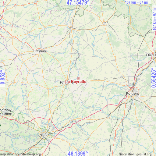
La Peyratte GPS coordinates[2]
46° 40' 28.2" North, 0° 8' 55.968" West
| Map corner | latitude | longitude |
|---|---|---|
| Upper-left | 47.15479°, | -0.852° |
| Center: | 46.6745°, | -0.14888° |
| Lower-right: | 46.1899°, | 0.55425° |
| Map W x H: | 107.3×107.3 km | = 66.7×66.7mi |
| max Lat: | 51.07786° ⇑58.5% North |
| La Peyratte: | 46.6745° |
| min Lat: | ⇓41.5% South 41.3874° |
| min Long | La Peyratte | max Long |
| -5.08615° | -0.14888° | 9.52242° |
| W 20.8%⇐ | ⇒79.2% E |
Elevation
Elevation of La Peyratte is 151 m = 495 ft, and this is 42.7 m = 140 ft below average elevation for this country.
| Max E: |
2333 m = 7654 ft | 44.7% |
| Avg. | 193.7 m = 635 ft | |
| La Peyratte | 151 m = 495 ft | |
Min E: |
-1 m = -3 ft | 55.3% |
See also: France elevation on elevation.city.
Geographical zone
La Peyratte is located in North temperate zone (between Tropic of Cancer and the Arctic Circle). Distance of this North polar circle is 2211.5 km =1374.2 mi to North.| Distance of | km | miles | from La Peyratte |
|---|---|---|---|
| North Pole | 4817.3 | 2993.3 | to North |
| Arctic Circle | 2211.5 | 1374.2 | to North |
| Tropic Cancer | 2583.8 | 1605.5 | to South |
| Equator | 5189.7 | 3224.7 | to South |


Nearby cities:
15 places around La Peyratte: (largest is in red/bold)
• Amailloux
15.1 km =9.4 mi,  302°
302°
• Assais-les-Jumeaux
14.3 km =8.9 mi,  31°
31°
• Beaulieu-sous-Parthenay
12.7 km =7.9 mi,  211°
211°
• Chalandray
11.3 km =7 mi,  97°
97°
• Cherves
13.6 km =8.5 mi,  69°
69°
• Châtillon-sur-Thouet
7 km =4.3 mi,  259°
259°
• Gourgé
6.1 km =3.8 mi,  346°
346°
• La Ferrière-en-Parthenay
5.8 km =3.6 mi,  109°
109°
• Le Tallud
12.4 km =7.7 mi,  246°
246°
• Louin
14.3 km =8.9 mi,  356°
356°
• Parthenay
8 km =5 mi, 248°
• Pompaire
9.8 km =6.1 mi,  221°
221°
• Thénezay
10.5 km =6.5 mi,  61°
61°
• Vasles
14.5 km =9 mi,  139°
139°
• Viennay
7.5 km =4.7 mi,  283°
283°
Sources, notices
• [Note1] Compared only with cities in France existing in our database
• [Src1] Map data: © OpenStreetMap contributors (CC-BY-SA)
• [Src2] Other city data from geonames.org with taken over terms of usage.
• [Src3] Geographical zone / Annual Mean Temperature by Robert A. Rohde @ Wikipedia
