La Chapelle-Yvon geodata
La Chapelle-Yvon (Normandy) is a populated place; located in France in Europe/Paris (GMT+2) time zone. With population of 523 people, there are 14759 cities with bigger population in this country. Compared to other cities in France, 81.2% of cities are located further ↓South; 74.9% of cities are located further →East and 62.8% of cities have higher elevation than La Chapelle-Yvon. Note1
Administrative division(s):
- Level 1: Normandy
- Level 2: Calvados
- Level 3: Arrondissement de Lisieux
- Level 4: Valorbiquet


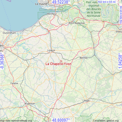
La Chapelle-Yvon GPS coordinates[2]
49° 3' 49.716" North, 0° 20' 22.02" East
| Map corner | latitude | longitude |
|---|---|---|
| Upper-left | 49.52238°, | -0.36368° |
| Center: | 49.06381°, | 0.33945° |
| Lower-right: | 48.60097°, | 1.04258° |
| Map W x H: | 102.5×102.4 km | = 63.7×63.6mi |
| max Lat: | 51.07786° ⇑18.8% North |
| La Chapelle-Yvon: | 49.06381° |
| min Lat: | ⇓81.2% South 41.3874° |
| min Long | La Chapelle-Yvo | max Long |
| -5.08615° | 0.33945° | 9.52242° |
| W 25.1%⇐ | ⇒74.9% E |
Elevation
Elevation of La Chapelle-Yvon is 95 m = 312 ft, and this is 98.7 m = 324 ft below average elevation for this country.
| Max E: |
2333 m = 7654 ft | 62.8% |
| Avg. | 193.7 m = 635 ft | |
| La Chapelle-Yvon | 95 m = 312 ft | |
Min E: |
-1 m = -3 ft | 37.2% |
See also: France elevation on elevation.city.
Geographical zone
La Chapelle-Yvon is located in North temperate zone (between Tropic of Cancer and the Arctic Circle). Distance of this North polar circle is 1945.8 km =1209.1 mi to North.| Distance of | km | miles | from La Chapelle-Yvon |
|---|---|---|---|
| North Pole | 4551.7 | 2828.3 | to North |
| Arctic Circle | 1945.8 | 1209.1 | to North |
| Tropic Cancer | 2849.5 | 1770.6 | to South |
| Equator | 5455.4 | 3389.8 | to South |


Nearby cities:
15 places around La Chapelle-Yvon: (largest is in red/bold)
• Beuvillers
9.6 km =6 mi,  319°
319°
• Courtonne-la-Meurdrac
7 km =4.3 mi,  348°
348°
• Courtonne-les-Deux-Églises
2.9 km =1.8 mi,  42°
42°
• Drucourt
10.8 km =6.7 mi,  57°
57°
• Fervaques
6.7 km =4.2 mi,  247°
247°
• Glos
7.7 km =4.8 mi,  326°
326°
• La Vespière
7.2 km =4.5 mi,  132°
132°
• Le Mesnil-Guillaume
5.9 km =3.7 mi, 320°
• Marolles
8.7 km =5.4 mi,  16°
16°
• Orbec
7.7 km =4.8 mi, 132°
• Saint-Cyr-du-Ronceray
3.3 km =2.1 mi, 248°
• Saint-Germain-de-Livet
10.1 km =6.3 mi,  277°
277°
• Saint-Germain-la-Campagne
5.1 km =3.2 mi,  109°
109°
• Saint-Martin-de-Mailloc
4.2 km =2.6 mi, 318°
• Saint-Martin-de-la-Lieue
10.4 km =6.5 mi,  301°
301°
Sources, notices
• [Note1] Compared only with cities in France existing in our database
• [Src1] Map data: © OpenStreetMap contributors (CC-BY-SA)
• [Src2] Other city data from geonames.org with taken over terms of usage.
• [Src3] Geographical zone / Annual Mean Temperature by Robert A. Rohde @ Wikipedia
