Drucourt geodata
Drucourt (Normandy) is a populated place; located in France in Europe/Paris (GMT+2) time zone. With population of 663 people, there are 12328 cities with bigger population in this country. Compared to other cities in France, 82.5% of cities are located further ↓South; 73.7% of cities are located further →East and 63.1% of cities have lower elevation than Drucourt. Note1
Administrative division(s):
- Level 1: Normandy
- Level 2: Département de l'Eure
- Level 3: Arrondissement de Bernay
- Level 4: Drucourt


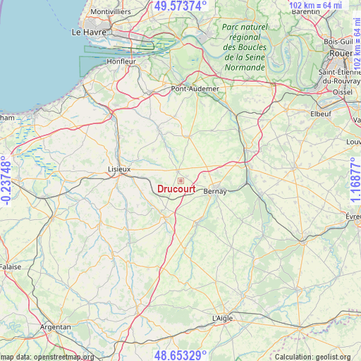
Drucourt GPS coordinates[2]
49° 6' 56.34" North, 0° 27' 56.34" East
| Map corner | latitude | longitude |
|---|---|---|
| Upper-left | 49.57374°, | -0.23748° |
| Center: | 49.11565°, | 0.46565° |
| Lower-right: | 48.65329°, | 1.16877° |
| Map W x H: | 102.3×102.3 km | = 63.6×63.6mi |
| max Lat: | 51.07786° ⇑17.5% North |
| Drucourt: | 49.11565° |
| min Lat: | ⇓82.5% South 41.3874° |
| min Long | Drucourt | max Long |
| -5.08615° | 0.46565° | 9.52242° |
| W 26.3%⇐ | ⇒73.7% E |
Elevation
Elevation of Drucourt is 185 m = 607 ft, and this is 8.7 m = 29 ft below average elevation for this country.
| Max E: |
2333 m = 7654 ft | 36.9% |
| Avg. | 193.7 m = 635 ft | |
| Drucourt | 185 m = 607 ft | |
Min E: |
-1 m = -3 ft | 63.1% |
See also: France elevation on elevation.city.
Geographical zone
Drucourt is located in North temperate zone (between Tropic of Cancer and the Arctic Circle). Distance of this North polar circle is 1940 km =1205.5 mi to North.| Distance of | km | miles | from Drucourt |
|---|---|---|---|
| North Pole | 4545.9 | 2824.7 | to North |
| Arctic Circle | 1940 | 1205.5 | to North |
| Tropic Cancer | 2855.2 | 1774.1 | to South |
| Equator | 5461.1 | 3393.4 | to South |


Nearby cities:
15 places around Drucourt: (largest is in red/bold)
• Bernay
10.1 km =6.3 mi,  107°
107°
• Caorches-Saint-Nicolas
7.1 km =4.4 mi,  120°
120°
• Courbépine
7.1 km =4.4 mi,  80°
80°
• Courtonne-la-Meurdrac
10.7 km =6.6 mi,  275°
275°
• Courtonne-les-Deux-Églises
8.1 km =5 mi,  243°
243°
• La Chapelle-Yvon
10.8 km =6.7 mi, 237°
• La Vespière
11.3 km =7 mi,  199°
199°
• Marolles
7.2 km =4.5 mi,  290°
290°
• Menneval
11.1 km =6.9 mi,  98°
98°
• Moyaux
11.9 km =7.4 mi,  317°
317°
• Orbec
11.6 km =7.2 mi, 197°
• Plasnes
11.7 km =7.3 mi, 78°
• Saint-Germain-la-Campagne
8.7 km =5.4 mi,  210°
210°
• Saint-Martin-de-Mailloc
12.3 km =7.6 mi,  257°
257°
• Thiberville
2.6 km =1.6 mi,  342°
342°
Sources, notices
• [Note1] Compared only with cities in France existing in our database
• [Src1] Map data: © OpenStreetMap contributors (CC-BY-SA)
• [Src2] Other city data from geonames.org with taken over terms of usage.
• [Src3] Geographical zone / Annual Mean Temperature by Robert A. Rohde @ Wikipedia
