La Chapelle-sur-Crécy geodata
La Chapelle-sur-Crécy (Île-de-France) is a populated place; located in France in Europe/Paris (GMT+2) time zone. With population of 4,249 people, there are 2315 cities with bigger population in this country. Compared to other cities in France, 76.8% of cities are located further ↓South; 56.7% of cities are located further ←West and 77% of cities have higher elevation than La Chapelle-sur-Crécy. Note1
Administrative division(s):
- Level 1: Île-de-France
- Level 2: Seine-et-Marne
- Level 3: Arrondissement de Meaux
- Level 4: Crécy-la-Chapelle
Current local time in La Chapelle-sur-Crécy:
04:48 AM, SaturdayDifference from your time zone: hours


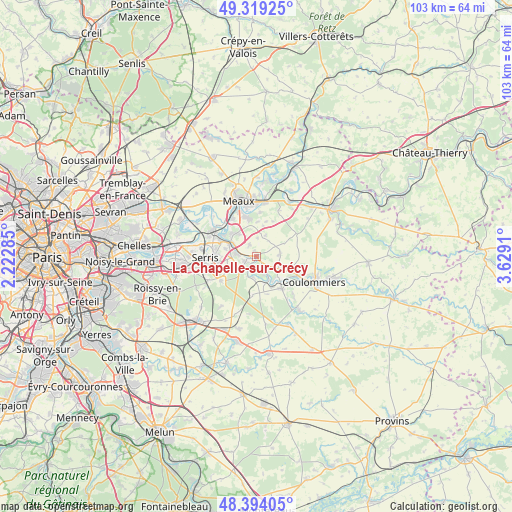
La Chapelle-sur-Crécy GPS coordinates[2]
48° 51' 31.644" North, 2° 55' 33.492" East
| Map corner | latitude | longitude |
|---|---|---|
| Upper-left | 49.31925°, | 2.22285° |
| Center: | 48.85879°, | 2.92597° |
| Lower-right: | 48.39405°, | 3.6291° |
| Map W x H: | 102.9×102.9 km | = 63.9×63.9mi |
| max Lat: | 51.07786° ⇑23.2% North |
| La Chapelle-sur-Crécy: | 48.85879° |
| min Lat: | ⇓76.8% South 41.3874° |
| min Long | La Chapelle-sur | max Long |
| -5.08615° | 2.92597° | 9.52242° |
| W 56.7%⇐ | ⇒43.3% E |
Elevation
Elevation of La Chapelle-sur-Crécy is 62 m = 203 ft, and this is 131.7 m = 432 ft below average elevation for this country.
| Max E: |
2333 m = 7654 ft | 77% |
| Avg. | 193.7 m = 635 ft | |
| La Chapelle-sur-Crécy | 62 m = 203 ft | |
Min E: |
-1 m = -3 ft | 23% |
See also: France elevation on elevation.city.
Geographical zone
La Chapelle-sur-Crécy is located in North temperate zone (between Tropic of Cancer and the Arctic Circle). Distance of this North polar circle is 1968.6 km =1223.2 mi to North.| Distance of | km | miles | from La Chapelle-sur-Crécy |
|---|---|---|---|
| North Pole | 4574.5 | 2842.5 | to North |
| Arctic Circle | 1968.6 | 1223.2 | to North |
| Tropic Cancer | 2826.7 | 1756.4 | to South |
| Equator | 5432.6 | 3375.7 | to South |


Nearby cities:
15 places around La Chapelle-sur-Crécy: (largest is in red/bold)
• Bailly-Romainvilliers
7.6 km =4.7 mi,  260°
260°
• Bouleurs
2.9 km =1.8 mi,  331°
331°
• Boutigny
6.9 km =4.3 mi,  2°
2°
• Condé-Sainte-Libiaire
7.6 km =4.7 mi,  303°
303°
• Couilly-Pont-aux-Dames
5.8 km =3.6 mi, 299°
• Coutevroult
5.4 km =3.4 mi,  274°
274°
• Dammartin-sur-Tigeaux
4.4 km =2.7 mi,  186°
186°
• Guérard
4.9 km =3 mi,  149°
149°
• La Celle-sur-Morin
6.1 km =3.8 mi, 148°
• Maisoncelles-en-Brie
4.9 km =3 mi,  80°
80°
• Montry
7.6 km =4.7 mi,  291°
291°
• Quincy-Voisins
6 km =3.7 mi,  321°
321°
• Saint-Germain-sur-Morin
6.1 km =3.8 mi, 295°
• Villiers-sur-Morin
3.5 km =2.2 mi, 273°
• Voulangis
2.3 km =1.4 mi,  252°
252°
Sources, notices
• [Note1] Compared only with cities in France existing in our database
• [Src1] Map data: © OpenStreetMap contributors (CC-BY-SA)
• [Src2] Other city data from geonames.org with taken over terms of usage.
• [Src3] Geographical zone / Annual Mean Temperature by Robert A. Rohde @ Wikipedia
