Kembs geodata
Kembs (Grand Est) is a populated place; located in France in Europe/Paris (GMT+2) time zone. With population of 3,909 people, there are 2516 cities with bigger population in this country. Compared to other cities in France, 54.1% of cities are located further ↓South; 98% of cities are located further ←West and 73.7% of cities have lower elevation than Kembs. Note1
Administrative division(s):
- Level 1: Grand Est
- Level 2: Haut-Rhin
- Level 3: Arrondissement de Mulhouse
- Level 4: Kembs


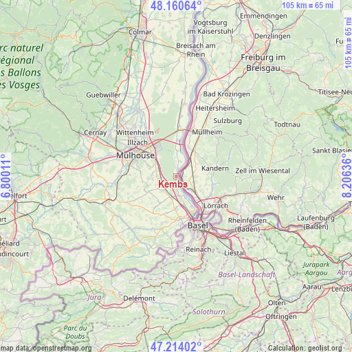
Kembs GPS coordinates[2]
47° 41' 22.128" North, 7° 30' 11.628" East
| Map corner | latitude | longitude |
|---|---|---|
| Upper-left | 48.16064°, | 6.80011° |
| Center: | 47.68948°, | 7.50323° |
| Lower-right: | 47.21402°, | 8.20636° |
| Map W x H: | 105.3×105.3 km | = 65.4×65.4mi |
| max Lat: | 51.07786° ⇑45.9% North |
| Kembs: | 47.68948° |
| min Lat: | ⇓54.1% South 41.3874° |
| min Long | Kembs | max Long |
| -5.08615° | 7.50323° | 9.52242° |
| W 98%⇐ | ⇒2% E |
Elevation
Elevation of Kembs is 240 m = 787 ft, and this is 46.3 m = 152 ft above average elevation for this country.
| Max E: |
2333 m = 7654 ft | 26.3% |
| Kembs | 240 m 787 ft | |
| Avg. | 193.7 m = 635 ft | |
Min E: |
-1 m = -3 ft | 73.7% |
See also: France elevation on elevation.city.
Geographical zone
Kembs is located in North temperate zone (between Tropic of Cancer and the Arctic Circle). Distance of this North polar circle is 2098.6 km =1304 mi to North.| Distance of | km | miles | from Kembs |
|---|---|---|---|
| North Pole | 4704.5 | 2923.2 | to North |
| Arctic Circle | 2098.6 | 1304 | to North |
| Tropic Cancer | 2696.7 | 1675.7 | to South |
| Equator | 5302.6 | 3294.9 | to South |


Nearby cities:
15 places around Kembs: (largest is in red/bold)
• Bartenheim
6.5 km =4 mi,  195°
195°
• Dietwiller
7.5 km =4.7 mi,  272°
272°
• Eschentzwiller
8.3 km =5.2 mi,  288°
288°
• Habsheim
7.8 km =4.8 mi,  305°
305°
• Hombourg
7.8 km =4.8 mi,  2°
2°
• Kappelen
9.2 km =5.7 mi,  211°
211°
• Landser
8.5 km =5.3 mi, 266°
• Niffer
2.7 km =1.7 mi,  9°
9°
• Petit-Landau
4.8 km =3 mi, 14°
• Rosenau
6.3 km =3.9 mi,  157°
157°
• Schlierbach
7.2 km =4.5 mi,  264°
264°
• Sierentz
5.1 km =3.2 mi,  226°
226°
• Uffheim
6.3 km =3.9 mi, 226°
• Waltenheim
6.8 km =4.2 mi,  238°
238°
• Zimmersheim
9.3 km =5.8 mi, 292°
Sources, notices
• [Note1] Compared only with cities in France existing in our database
• [Src1] Map data: © OpenStreetMap contributors (CC-BY-SA)
• [Src2] Other city data from geonames.org with taken over terms of usage.
• [Src3] Geographical zone / Annual Mean Temperature by Robert A. Rohde @ Wikipedia
