Javené geodata
Javené (Brittany) is a populated place; located in France in Europe/Paris (GMT+2) time zone. With population of 1,682 people, there are 5567 cities with bigger population in this country. Compared to other cities in France, 64.9% of cities are located further ↓South; 90.1% of cities are located further →East and 64.4% of cities have higher elevation than Javené. Note1
Administrative division(s):
- Level 1: Brittany
- Level 2: Département d'Ille-et-Vilaine
- Level 3: Arrondissement de Fougères-Vitré
- Level 4: Javené


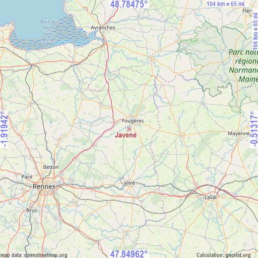
Javené GPS coordinates[2]
48° 19' 9.588" North, 1° 12' 58.68" West
| Map corner | latitude | longitude |
|---|---|---|
| Upper-left | 48.78475°, | -1.91942° |
| Center: | 48.31933°, | -1.2163° |
| Lower-right: | 47.84962°, | -0.51317° |
| Map W x H: | 104×104 km | = 64.6×64.6mi |
| max Lat: | 51.07786° ⇑35.1% North |
| Javené: | 48.31933° |
| min Lat: | ⇓64.9% South 41.3874° |
| min Long | Javené | max Long |
| -5.08615° | -1.2163° | 9.52242° |
| W 9.9%⇐ | ⇒90.1% E |
Elevation
Elevation of Javené is 91 m = 299 ft, and this is 102.7 m = 337 ft below average elevation for this country.
| Max E: |
2333 m = 7654 ft | 64.4% |
| Avg. | 193.7 m = 635 ft | |
| Javené | 91 m = 299 ft | |
Min E: |
-1 m = -3 ft | 35.6% |
See also: France elevation on elevation.city.
Geographical zone
Javené is located in North temperate zone (between Tropic of Cancer and the Arctic Circle). Distance of this North polar circle is 2028.6 km =1260.5 mi to North.| Distance of | km | miles | from Javené |
|---|---|---|---|
| North Pole | 4634.5 | 2879.7 | to North |
| Arctic Circle | 2028.6 | 1260.5 | to North |
| Tropic Cancer | 2766.7 | 1719.1 | to South |
| Equator | 5372.6 | 3338.4 | to South |


Nearby cities:
15 places around Javené: (largest is in red/bold)
• Beaucé
4.8 km =3 mi,  63°
63°
• Billé
4.2 km =2.6 mi,  212°
212°
• Dompierre-du-Chemin
8.1 km =5 mi,  136°
136°
• Fleurigné
7.2 km =4.5 mi,  75°
75°
• Fougères
3.8 km =2.4 mi,  18°
18°
• La Chapelle-Janson
9 km =5.6 mi,  69°
69°
• La Selle-en-Luitré
6.6 km =4.1 mi,  98°
98°
• Laignelet
7.3 km =4.5 mi,  40°
40°
• Luitré
8.3 km =5.2 mi,  119°
119°
• Lécousse
5 km =3.1 mi,  2°
2°
• Parcé
5.3 km =3.3 mi,  167°
167°
• Romagné
5.1 km =3.2 mi,  297°
297°
• Saint-Christophe-des-Bois
10.6 km =6.6 mi,  192°
192°
• Saint-Germain-en-Coglès
10.2 km =6.3 mi,  339°
339°
• Saint-Sauveur-des-Landes
7.6 km =4.7 mi,  290°
290°
Sources, notices
• [Note1] Compared only with cities in France existing in our database
• [Src1] Map data: © OpenStreetMap contributors (CC-BY-SA)
• [Src2] Other city data from geonames.org with taken over terms of usage.
• [Src3] Geographical zone / Annual Mean Temperature by Robert A. Rohde @ Wikipedia
