Luitré geodata
Luitré (Brittany) is a populated place; located in France in Europe/Paris (GMT+2) time zone. With population of 1,298 people, there are 7038 cities with bigger population in this country. Compared to other cities in France, 64.2% of cities are located further ↓South; 89.3% of cities are located further →East and 53.9% of cities have lower elevation than Luitré. Note1
Administrative division(s):
- Level 1: Brittany
- Level 2: Département d'Ille-et-Vilaine
- Level 3: Arrondissement de Fougères-Vitré
- Level 4: Luitré-Dompierre


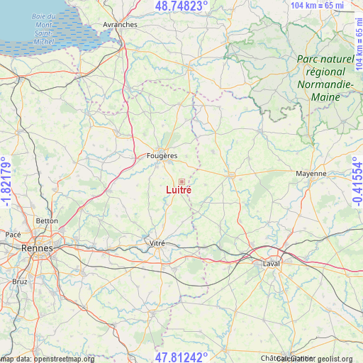
Luitré GPS coordinates[2]
48° 16' 56.892" North, 1° 7' 7.176" West
| Map corner | latitude | longitude |
|---|---|---|
| Upper-left | 48.74823°, | -1.82179° |
| Center: | 48.28247°, | -1.11866° |
| Lower-right: | 47.81242°, | -0.41554° |
| Map W x H: | 104.1×10⁴ km | = 64.7×64.6mi |
| max Lat: | 51.07786° ⇑35.8% North |
| Luitré: | 48.28247° |
| min Lat: | ⇓64.2% South 41.3874° |
| min Long | Luitré | max Long |
| -5.08615° | -1.11866° | 9.52242° |
| W 10.7%⇐ | ⇒89.3% E |
Elevation
Elevation of Luitré is 146 m = 479 ft, and this is 47.7 m = 156 ft below average elevation for this country.
| Max E: |
2333 m = 7654 ft | 46.1% |
| Avg. | 193.7 m = 635 ft | |
| Luitré | 146 m = 479 ft | |
Min E: |
-1 m = -3 ft | 53.9% |
See also: France elevation on elevation.city.
Geographical zone
Luitré is located in North temperate zone (between Tropic of Cancer and the Arctic Circle). Distance of this North polar circle is 2032.7 km =1263.1 mi to North.| Distance of | km | miles | from Luitré |
|---|---|---|---|
| North Pole | 4638.6 | 2882.3 | to North |
| Arctic Circle | 2032.7 | 1263.1 | to North |
| Tropic Cancer | 2762.6 | 1716.6 | to South |
| Equator | 5368.5 | 3335.8 | to South |


Nearby cities:
15 places around Luitré: (largest is in red/bold)
• Beaucé
6.9 km =4.3 mi,  335°
335°
• Billé
9.5 km =5.9 mi,  273°
273°
• Châtillon-en-Vendelais
7.8 km =4.8 mi,  213°
213°
• Dompierre-du-Chemin
2.5 km =1.6 mi,  222°
222°
• Fleurigné
5.9 km =3.7 mi,  357°
357°
• Fougères
9.8 km =6.1 mi,  322°
322°
• Javené
8.3 km =5.2 mi,  299°
299°
• Juvigné
8.6 km =5.3 mi,  133°
133°
• La Chapelle-Janson
7.4 km =4.6 mi,  9°
9°
• La Croixille
9.7 km =6 mi,  152°
152°
• La Selle-en-Luitré
3.2 km =2 mi,  348°
348°
• Laignelet
9.9 km =6.2 mi, 345°
• Parcé
6.2 km =3.9 mi,  260°
260°
• Saint-Christophe-des-Bois
11.4 km =7.1 mi,  236°
236°
• Saint-Pierre-des-Landes
6.8 km =4.2 mi,  97°
97°
Sources, notices
• [Note1] Compared only with cities in France existing in our database
• [Src1] Map data: © OpenStreetMap contributors (CC-BY-SA)
• [Src2] Other city data from geonames.org with taken over terms of usage.
• [Src3] Geographical zone / Annual Mean Temperature by Robert A. Rohde @ Wikipedia
