La Selle-en-Luitré geodata
La Selle-en-Luitré (Brittany) is a populated place; located in France in Europe/Paris (GMT+2) time zone. With population of 506 people, there are 15128 cities with bigger population in this country. Compared to other cities in France, 64.7% of cities are located further ↓South; 89.4% of cities are located further →East and 59.4% of cities have higher elevation than La Selle-en-Luitré. Note1
Administrative division(s):
- Level 1: Brittany
- Level 2: Département d'Ille-et-Vilaine
- Level 3: Arrondissement de Fougères-Vitré
- Level 4: La Selle-en-Luitré


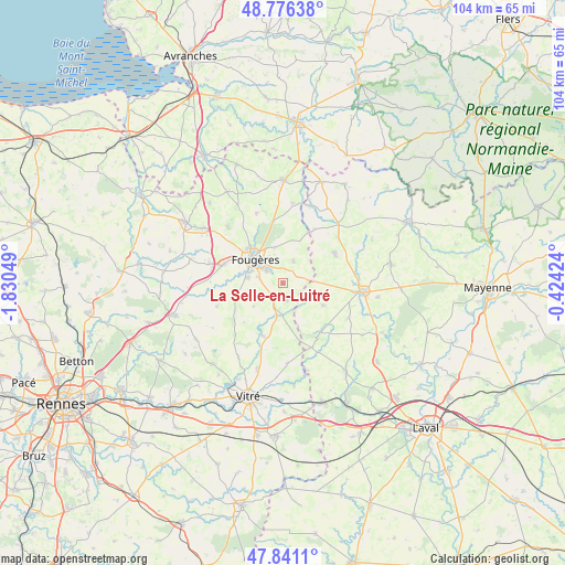
La Selle-en-Luitré GPS coordinates[2]
48° 18' 39.168" North, 1° 7' 38.496" West
| Map corner | latitude | longitude |
|---|---|---|
| Upper-left | 48.77638°, | -1.83049° |
| Center: | 48.31088°, | -1.12736° |
| Lower-right: | 47.8411°, | -0.42424° |
| Map W x H: | 104×104 km | = 64.6×64.6mi |
| max Lat: | 51.07786° ⇑35.3% North |
| La Selle-en-Luitré: | 48.31088° |
| min Lat: | ⇓64.7% South 41.3874° |
| min Long | La Selle-en-Lui | max Long |
| -5.08615° | -1.12736° | 9.52242° |
| W 10.6%⇐ | ⇒89.4% E |
Elevation
Elevation of La Selle-en-Luitré is 104 m = 341 ft, and this is 89.7 m = 294 ft below average elevation for this country.
| Max E: |
2333 m = 7654 ft | 59.4% |
| Avg. | 193.7 m = 635 ft | |
| La Selle-en-Luitré | 104 m = 341 ft | |
Min E: |
-1 m = -3 ft | 40.6% |
See also: France elevation on elevation.city.
Geographical zone
La Selle-en-Luitré is located in North temperate zone (between Tropic of Cancer and the Arctic Circle). Distance of this North polar circle is 2029.5 km =1261.1 mi to North.| Distance of | km | miles | from La Selle-en-Luitré |
|---|---|---|---|
| North Pole | 4635.4 | 2880.3 | to North |
| Arctic Circle | 2029.5 | 1261.1 | to North |
| Tropic Cancer | 2765.7 | 1718.5 | to South |
| Equator | 5371.7 | 3337.8 | to South |


Nearby cities:
15 places around La Selle-en-Luitré: (largest is in red/bold)
• Beaucé
3.9 km =2.4 mi,  323°
323°
• Billé
9.2 km =5.7 mi,  253°
253°
• Châtillon-en-Vendelais
10.3 km =6.4 mi,  200°
200°
• Dompierre-du-Chemin
5.1 km =3.2 mi,  191°
191°
• Fleurigné
2.8 km =1.7 mi,  7°
7°
• Fougères
7 km =4.3 mi,  310°
310°
• Javené
6.6 km =4.1 mi,  278°
278°
• La Chapelle-Janson
4.5 km =2.8 mi,  24°
24°
• Laignelet
6.7 km =4.2 mi,  344°
344°
• Larchamp
11 km =6.8 mi,  59°
59°
• Le Loroux
10.4 km =6.5 mi,  26°
26°
• Luitré
3.2 km =2 mi,  168°
168°
• Lécousse
8.7 km =5.4 mi, 313°
• Parcé
6.9 km =4.3 mi,  232°
232°
• Saint-Pierre-des-Landes
8.4 km =5.2 mi,  119°
119°
Sources, notices
• [Note1] Compared only with cities in France existing in our database
• [Src1] Map data: © OpenStreetMap contributors (CC-BY-SA)
• [Src2] Other city data from geonames.org with taken over terms of usage.
• [Src3] Geographical zone / Annual Mean Temperature by Robert A. Rohde @ Wikipedia
