Ivoy-le-Pré geodata
Ivoy-le-Pré (Centre) is a populated place; located in France in Europe/Paris (GMT+2) time zone. With population of 877 people, there are 9840 cities with bigger population in this country. Compared to other cities in France, 50.8% of cities are located further ↑North; 50.4% of cities are located further ←West and 77.6% of cities have lower elevation than Ivoy-le-Pré. Note1
Administrative division(s):
- Level 1: Centre
- Level 2: Cher
- Level 3: Arrondissement de Vierzon
- Level 4: Ivoy-le-Pré


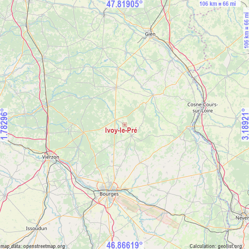
Ivoy-le-Pré GPS coordinates[2]
47° 20' 41.172" North, 2° 29' 9.924" East
| Map corner | latitude | longitude |
|---|---|---|
| Upper-left | 47.81905°, | 1.78296° |
| Center: | 47.34477°, | 2.48609° |
| Lower-right: | 46.86619°, | 3.18921° |
| Map W x H: | 105.9×105.9 km | = 65.8×65.8mi |
| max Lat: | 51.07786° ⇑50.8% North |
| Ivoy-le-Pré: | 47.34477° |
| min Lat: | ⇓49.2% South 41.3874° |
| min Long | Ivoy-le-Pré | max Long |
| -5.08615° | 2.48609° | 9.52242° |
| W 50.4%⇐ | ⇒49.6% E |
Elevation
Elevation of Ivoy-le-Pré is 269 m = 883 ft, and this is 75.3 m = 247 ft above average elevation for this country.
| Max E: |
2333 m = 7654 ft | 22.4% |
| Ivoy-le-Pré | 269 m 883 ft | |
| Avg. | 193.7 m = 635 ft | |
Min E: |
-1 m = -3 ft | 77.6% |
See also: France elevation on elevation.city.
Geographical zone
Ivoy-le-Pré is located in North temperate zone (between Tropic of Cancer and the Arctic Circle). Distance of this North polar circle is 2136.9 km =1327.8 mi to North.| Distance of | km | miles | from Ivoy-le-Pré |
|---|---|---|---|
| North Pole | 4742.8 | 2947 | to North |
| Arctic Circle | 2136.9 | 1327.8 | to North |
| Tropic Cancer | 2658.3 | 1651.8 | to South |
| Equator | 5264.2 | 3271 | to South |


Nearby cities:
15 places around Ivoy-le-Pré: (largest is in red/bold)
• Allogny
18.2 km =11.3 mi,  223°
223°
• Aubigny-sur-Nère
16.3 km =10.1 mi,  347°
347°
• Henrichemont
5.4 km =3.4 mi,  147°
147°
• Jars
15.8 km =9.8 mi,  69°
69°
• Les Aix-d’Angillon
17.5 km =10.9 mi,  160°
160°
• Menetou-Salon
12.6 km =7.8 mi,  179°
179°
• Méry-ès-Bois
9.9 km =6.2 mi,  250°
250°
• Neuvy-sur-Barangeon
17.8 km =11.1 mi,  259°
259°
• Oizon
14.7 km =9.1 mi,  7°
7°
• Pigny
19.1 km =11.9 mi,  190°
190°
• Saint-Georges-sur-Moulon
17.8 km =11.1 mi,  195°
195°
• Saint-Martin-d’Auxigny
16.6 km =10.3 mi, 198°
• Saint-Palais
13.4 km =8.3 mi, 201°
• Vailly-sur-Sauldre
17.7 km =11 mi,  44°
44°
• Vignoux-sous-les-Aix
17.5 km =10.9 mi, 185°
Sources, notices
• [Note1] Compared only with cities in France existing in our database
• [Src1] Map data: © OpenStreetMap contributors (CC-BY-SA)
• [Src2] Other city data from geonames.org with taken over terms of usage.
• [Src3] Geographical zone / Annual Mean Temperature by Robert A. Rohde @ Wikipedia
