Allogny geodata
Allogny (Centre) is a populated place; located in France in Europe/Paris (GMT+2) time zone. With population of 900 people, there are 9657 cities with bigger population in this country. Compared to other cities in France, 52.6% of cities are located further ↑North; 52.4% of cities are located further →East and 68.1% of cities have lower elevation than Allogny. Note1
Administrative division(s):
- Level 1: Centre
- Level 2: Cher
- Level 3: Arrondissement de Bourges
- Level 4: Allogny


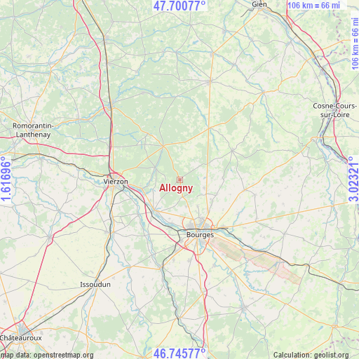
Allogny GPS coordinates[2]
47° 13' 31.512" North, 2° 19' 12.324" East
| Map corner | latitude | longitude |
|---|---|---|
| Upper-left | 47.70077°, | 1.61696° |
| Center: | 47.22542°, | 2.32009° |
| Lower-right: | 46.74577°, | 3.02321° |
| Map W x H: | 106.2×106.2 km | = 66×66mi |
| max Lat: | 51.07786° ⇑52.6% North |
| Allogny: | 47.22542° |
| min Lat: | ⇓47.4% South 41.3874° |
| min Long | Allogny | max Long |
| -5.08615° | 2.32009° | 9.52242° |
| W 47.6%⇐ | ⇒52.4% E |
Elevation
Elevation of Allogny is 210 m = 689 ft, and this is 16.3 m = 53 ft above average elevation for this country.
| Max E: |
2333 m = 7654 ft | 31.9% |
| Allogny | 210 m 689 ft | |
| Avg. | 193.7 m = 635 ft | |
Min E: |
-1 m = -3 ft | 68.1% |
See also: France elevation on elevation.city.
Geographical zone
Allogny is located in North temperate zone (between Tropic of Cancer and the Arctic Circle). Distance of this North polar circle is 2150.2 km =1336.1 mi to North.| Distance of | km | miles | from Allogny |
|---|---|---|---|
| North Pole | 4756.1 | 2955.3 | to North |
| Arctic Circle | 2150.2 | 1336.1 | to North |
| Tropic Cancer | 2645.1 | 1643.6 | to South |
| Equator | 5251 | 3262.8 | to South |


Nearby cities:
15 places around Allogny: (largest is in red/bold)
• Allouis
9.7 km =6 mi,  226°
226°
• Fussy
12.3 km =7.6 mi,  137°
137°
• Mehun-sur-Yèvre
12.8 km =8 mi,  220°
220°
• Menetou-Salon
12.6 km =7.8 mi,  86°
86°
• Méry-ès-Bois
10.4 km =6.5 mi,  18°
18°
• Neuvy-sur-Barangeon
11.2 km =7 mi,  333°
333°
• Pigny
10.6 km =6.6 mi,  121°
121°
• Saint-Georges-sur-Moulon
8.7 km =5.4 mi, 116°
• Saint-Martin-d’Auxigny
7.6 km =4.7 mi,  108°
108°
• Saint-Palais
7.6 km =4.7 mi,  83°
83°
• Saint-Éloy-de-Gy
8 km =5 mi,  167°
167°
• Vasselay
9.3 km =5.8 mi,  145°
145°
• Vignoux-sous-les-Aix
11.7 km =7.3 mi, 110°
• Vignoux-sur-Barangeon
11.5 km =7.1 mi,  256°
256°
• Vouzeron
8.3 km =5.2 mi,  297°
297°
Sources, notices
• [Note1] Compared only with cities in France existing in our database
• [Src1] Map data: © OpenStreetMap contributors (CC-BY-SA)
• [Src2] Other city data from geonames.org with taken over terms of usage.
• [Src3] Geographical zone / Annual Mean Temperature by Robert A. Rohde @ Wikipedia
