Jars geodata
Jars (Centre) is a populated place; located in France in Europe/Paris (GMT+2) time zone. With population of 512 people, there are 14990 cities with bigger population in this country. Compared to other cities in France, 50.1% of cities are located further ↑North; 53.2% of cities are located further ←West and 77.3% of cities have lower elevation than Jars. Note1
Administrative division(s):
- Level 1: Centre
- Level 2: Cher
- Level 3: Arrondissement de Bourges
- Level 4: Jars


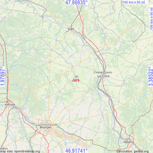
Jars GPS coordinates[2]
47° 23' 43.908" North, 2° 40' 55.56" East
| Map corner | latitude | longitude |
|---|---|---|
| Upper-left | 47.86935°, | 1.97897° |
| Center: | 47.39553°, | 2.6821° |
| Lower-right: | 46.91741°, | 3.38522° |
| Map W x H: | 105.8×105.8 km | = 65.7×65.7mi |
| max Lat: | 51.07786° ⇑50.1% North |
| Jars: | 47.39553° |
| min Lat: | ⇓49.9% South 41.3874° |
| min Long | Jars | max Long |
| -5.08615° | 2.6821° | 9.52242° |
| W 53.2%⇐ | ⇒46.8% E |
Elevation
Elevation of Jars is 266 m = 873 ft, and this is 72.3 m = 237 ft above average elevation for this country.
| Max E: |
2333 m = 7654 ft | 22.7% |
| Jars | 266 m 873 ft | |
| Avg. | 193.7 m = 635 ft | |
Min E: |
-1 m = -3 ft | 77.3% |
See also: France elevation on elevation.city.
Geographical zone
Jars is located in North temperate zone (between Tropic of Cancer and the Arctic Circle). Distance of this North polar circle is 2131.3 km =1324.3 mi to North.| Distance of | km | miles | from Jars |
|---|---|---|---|
| North Pole | 4737.2 | 2943.6 | to North |
| Arctic Circle | 2131.3 | 1324.3 | to North |
| Tropic Cancer | 2664 | 1655.3 | to South |
| Equator | 5269.9 | 3274.6 | to South |


Nearby cities:
15 places around Jars: (largest is in red/bold)
• Bannay
15.2 km =9.4 mi,  93°
93°
• Belleville-sur-Loire
17.2 km =10.7 mi,  47°
47°
• Boulleret
14.7 km =9.1 mi,  77°
77°
• Crézancy-en-Sancerre
11.8 km =7.3 mi,  154°
154°
• Henrichemont
15.7 km =9.8 mi,  229°
229°
• Ivoy-le-Pré
15.8 km =9.8 mi,  249°
249°
• Léré
16.3 km =10.1 mi,  60°
60°
• Oizon
15.5 km =9.6 mi,  305°
305°
• Saint-Satur
13.3 km =8.3 mi,  118°
118°
• Sancerre
13.7 km =8.5 mi, 122°
• Savigny-en-Sancerre
10.9 km =6.8 mi, 61°
• Sury-en-Vaux
9.7 km =6 mi,  108°
108°
• Sury-près-Léré
17.1 km =10.6 mi, 54°
• Vailly-sur-Sauldre
7.5 km =4.7 mi,  341°
341°
• Veaugues
16.4 km =10.2 mi,  159°
159°
Sources, notices
• [Note1] Compared only with cities in France existing in our database
• [Src1] Map data: © OpenStreetMap contributors (CC-BY-SA)
• [Src2] Other city data from geonames.org with taken over terms of usage.
• [Src3] Geographical zone / Annual Mean Temperature by Robert A. Rohde @ Wikipedia
