Pigny geodata
Pigny (Centre) is a populated place; located in France in Europe/Paris (GMT+2) time zone. With population of 724 people, there are 11480 cities with bigger population in this country. Compared to other cities in France, 53.3% of cities are located further ↑North; 50.4% of cities are located further →East and 61.3% of cities have lower elevation than Pigny. Note1
Administrative division(s):
- Level 1: Centre
- Level 2: Cher
- Level 3: Arrondissement de Bourges
- Level 4: Pigny


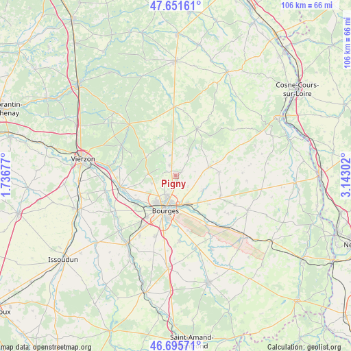
Pigny GPS coordinates[2]
47° 10' 32.916" North, 2° 26' 23.64" East
| Map corner | latitude | longitude |
|---|---|---|
| Upper-left | 47.65161°, | 1.73677° |
| Center: | 47.17581°, | 2.4399° |
| Lower-right: | 46.69571°, | 3.14302° |
| Map W x H: | 106.3×106.3 km | = 66.1×66.1mi |
| max Lat: | 51.07786° ⇑53.3% North |
| Pigny: | 47.17581° |
| min Lat: | ⇓46.7% South 41.3874° |
| min Long | Pigny | max Long |
| -5.08615° | 2.4399° | 9.52242° |
| W 49.6%⇐ | ⇒50.4% E |
Elevation
Elevation of Pigny is 176 m = 577 ft, and this is 17.7 m = 58 ft below average elevation for this country.
| Max E: |
2333 m = 7654 ft | 38.7% |
| Avg. | 193.7 m = 635 ft | |
| Pigny | 176 m = 577 ft | |
Min E: |
-1 m = -3 ft | 61.3% |
See also: France elevation on elevation.city.
Geographical zone
Pigny is located in North temperate zone (between Tropic of Cancer and the Arctic Circle). Distance of this North polar circle is 2155.7 km =1339.5 mi to North.| Distance of | km | miles | from Pigny |
|---|---|---|---|
| North Pole | 4761.6 | 2958.7 | to North |
| Arctic Circle | 2155.7 | 1339.5 | to North |
| Tropic Cancer | 2639.5 | 1640.1 | to South |
| Equator | 5245.5 | 3259.4 | to South |


Nearby cities:
15 places around Pigny: (largest is in red/bold)
• Allogny
10.6 km =6.6 mi,  301°
301°
• Bourges
10.7 km =6.6 mi,  196°
196°
• Fussy
3.7 km =2.3 mi,  192°
192°
• Les Aix-d’Angillon
9.7 km =6 mi,  76°
76°
• Menetou-Salon
7.2 km =4.5 mi,  29°
29°
• Rians
13.1 km =8.1 mi,  88°
88°
• Saint-Doulchard
10.4 km =6.5 mi,  219°
219°
• Saint-Georges-sur-Moulon
2.1 km =1.3 mi,  322°
322°
• Saint-Germain-du-Puy
9 km =5.6 mi,  158°
158°
• Saint-Martin-d’Auxigny
3.6 km =2.2 mi,  329°
329°
• Saint-Palais
6.5 km =4 mi,  346°
346°
• Saint-Éloy-de-Gy
7.7 km =4.8 mi,  252°
252°
• Sainte-Solange
9.4 km =5.8 mi,  117°
117°
• Vasselay
4.3 km =2.7 mi,  240°
240°
• Vignoux-sous-les-Aix
2.3 km =1.4 mi,  53°
53°
Sources, notices
• [Note1] Compared only with cities in France existing in our database
• [Src1] Map data: © OpenStreetMap contributors (CC-BY-SA)
• [Src2] Other city data from geonames.org with taken over terms of usage.
• [Src3] Geographical zone / Annual Mean Temperature by Robert A. Rohde @ Wikipedia
