Itancourt geodata
Itancourt (Hauts-de-France) is a populated place; located in France in Europe/Paris (GMT+2) time zone. With population of 1,055 people, there are 8433 cities with bigger population in this country. Compared to other cities in France, 92.3% of cities are located further ↓South; 62.5% of cities are located further ←West and 54.4% of cities have higher elevation than Itancourt. Note1
Administrative division(s):
- Level 1: Hauts-de-France
- Level 2: Département de l'Aisne
- Level 3: Arrondissement de Saint-Quentin
- Level 4: Itancourt


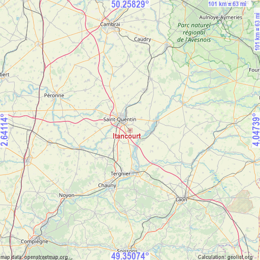
Itancourt GPS coordinates[2]
49° 48' 23.904" North, 3° 20' 39.372" East
| Map corner | latitude | longitude |
|---|---|---|
| Upper-left | 50.25829°, | 2.64114° |
| Center: | 49.80664°, | 3.34427° |
| Lower-right: | 49.35074°, | 4.04739° |
| Map W x H: | 100.9×100.9 km | = 62.7×62.7mi |
| max Lat: | 51.07786° ⇑7.7% North |
| Itancourt: | 49.80664° |
| min Lat: | ⇓92.3% South 41.3874° |
| min Long | Itancourt | max Long |
| -5.08615° | 3.34427° | 9.52242° |
| W 62.5%⇐ | ⇒37.5% E |
Elevation
Elevation of Itancourt is 118 m = 387 ft, and this is 75.7 m = 248 ft below average elevation for this country.
| Max E: |
2333 m = 7654 ft | 54.4% |
| Avg. | 193.7 m = 635 ft | |
| Itancourt | 118 m = 387 ft | |
Min E: |
-1 m = -3 ft | 45.6% |
See also: France elevation on elevation.city.
Geographical zone
Itancourt is located in North temperate zone (between Tropic of Cancer and the Arctic Circle). Distance of this North polar circle is 1863.2 km =1157.7 mi to North.| Distance of | km | miles | from Itancourt |
|---|---|---|---|
| North Pole | 4469.1 | 2777 | to North |
| Arctic Circle | 1863.2 | 1157.7 | to North |
| Tropic Cancer | 2932.1 | 1821.9 | to South |
| Equator | 5538 | 3441.2 | to South |


Nearby cities:
15 places around Itancourt: (largest is in red/bold)
• Essigny-le-Grand
5.7 km =3.5 mi,  236°
236°
• Gauchy
5.6 km =3.5 mi,  294°
294°
• Grugies
5.5 km =3.4 mi,  276°
276°
• Harly
4.2 km =2.6 mi,  324°
324°
• Homblières
5.1 km =3.2 mi,  16°
16°
• Morcourt
7.7 km =4.8 mi,  348°
348°
• Mézières-sur-Oise
4.9 km =3 mi,  121°
121°
• Neuville-Saint-Amand
2.3 km =1.4 mi,  340°
340°
• Omissy
8.2 km =5.1 mi, 343°
• Ribemont
8.3 km =5.2 mi,  98°
98°
• Saint-Quentin
6.2 km =3.9 mi, 319°
• Sissy
6 km =3.7 mi, 95°
• Séry-lès-Mézières
6.7 km =4.2 mi, 123°
• Thenelles
9.1 km =5.7 mi,  73°
73°
• Urvillers
3.1 km =1.9 mi,  233°
233°
Sources, notices
• [Note1] Compared only with cities in France existing in our database
• [Src1] Map data: © OpenStreetMap contributors (CC-BY-SA)
• [Src2] Other city data from geonames.org with taken over terms of usage.
• [Src3] Geographical zone / Annual Mean Temperature by Robert A. Rohde @ Wikipedia
